Country United States of America | ||
 | ||
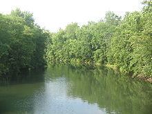
Bald Eagle Creek is a 55.2-mile-long (88.8 km) tributary of the West Branch Susquehanna River mostly in Centre County, Pennsylvania, in the United States.
Contents
Map of Bald Eagle Creek, Pennsylvania, USA
Bald Eagle Creek runs through the Bald Eagle Valley at the foot of the Bald Eagle Mountain ridge to Lock Haven.
The shorter Bald Eagle Creek (Little Juniata River) runs south in the valley from the same headlands near the Blair County/Centre County line, terminating in the Little Juniata River in Tyrone.
The main line of the Nittany and Bald Eagle Railroad short line runs along the full length of both Bald Eagle creeks. Interstate 80 crosses the creek between Snow Shoe and Bellefonte, and U.S. Route 322 crosses between Port Matilda and State College. Much of the Nittany Valley drains to the creek through water gaps in the Bald Eagle Mountain ridge.
Located along the creek in Unionville is the Fisher Farm Site, a significant archaeological site.
Principal towns on Bald Eagle CreekEdit
From southwest to northeast, downstream along the longer Bald Eagle Creek:
