
Country Philippines Founded 1866 Time zone PST (UTC+8) Local time Tuesday 4:23 PM | District 2nd District Barangays Area 231.2 km² Province Bataan | |
 | ||
Region Central Luzon (Region III) Weather 29°C, Wind E at 23 km/h, 59% Humidity Neighborhoods Banawang, Paysawan, Atilano L. Ricardo, San Antonio, Bagumbayan, Binukawan, Pag-asa, Tabing-Ilog, Ibaba Points of interest Pantingan Peak, Stella Maris Beach Re, Mount Mariveles, Looc Beach, Friendship tower | ||
Ub mga beach sa bagac bataan dinarayo dahil sa tahimik at malinis
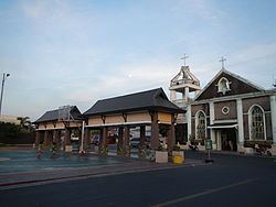
Bagac, officially the Municipality of Bagac (Filipino: Bayan ng Bagac; Kapampangan: Balen ning Bagac), is a municipality in the province of Bataan in the Central Luzon (Region III) of the Philippines. The population was 26,936 at the 2015 census. In the 2016 electoral roll, it had 22,230 registered voters.
Contents
- Ub mga beach sa bagac bataan dinarayo dahil sa tahimik at malinis
- Map of Bagac Bataan Philippines
- Unexpected trip to montemar beach in bagac bataan philippines
- Geography
- Barangays
- Demographics
- Attractions
- Popular culture
- References
Map of Bagac, Bataan, Philippines
With an area of 231.20 square kilometres (89.27 sq mi), Bagac is the largest municipality in Bataan.
Unexpected trip to montemar beach in bagac bataan philippines
Geography
Bagac is located at 14°36′N 120°24′E.
According to the Philippine Statistics Authority, the municipality has a land area of 231.20 square kilometres (89.27 sq mi) constituting 7001168400000000000♠16.84% of the 1,372.98-square-kilometre- (530.11 sq mi) total area of Bataan.
Barangays
Bagac is politically subdivided into 14 barangays.
Demographics
In the 2015 census, Bagac had a population of 26,936. The population density was 120 inhabitants per square kilometre (310/sq mi).
In the 2016 electoral roll, it had 22,230 registered voters.