
Length 3,595 km | Constructed 1 February 1959 | |
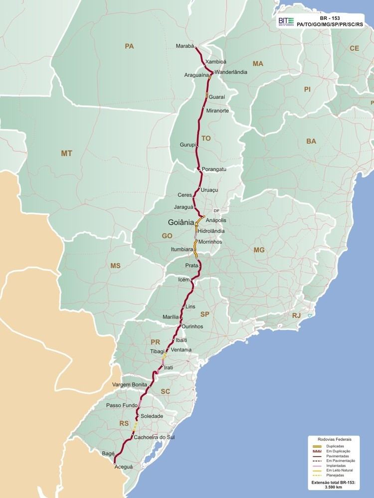 | ||
Existed: February 1, 1959 – present North end: São Domingos do Araguaia, Pará South end: Aceguá, Rio Grande do Sul / Brazil-Uruguay border | ||
The BR-153 is a major federal highway of Brazil, officially named as Transbrasiliana Highway, and also as Belém-Brasília Highway in the stretch located between the cities of Wanderlândia, in Tocantins, and Anápolis, in Goiás.
Map of BR-153, Brazil
It crosses Brazil in the North-South direction, starting in São Domingos do Araguaia, state of Pará and ending in Aceguá, in the state of Rio Grande do Sul on the Brazil/Uruguay border. The highway, highly variable in quality and traffic, cuts through the states of Pará, Tocantins, Goiás, Minas Gerais, São Paulo, Paraná, Santa Catarina and Rio Grande do Sul.
References
BR-153 Wikipedia(Text) CC BY-SA