
Country Turkey Time zone EET (UTC+2) Licence plate 06 Elevation 910 m Local time Friday 9:29 PM Province Ankara Province | Region Central Anatolia Postal code 06xxx Website www.ayas.bel.tr Area 1,158 km² Area code 0312 | |
 | ||
Weather 6°C, Wind N at 10 km/h, 74% Humidity | ||
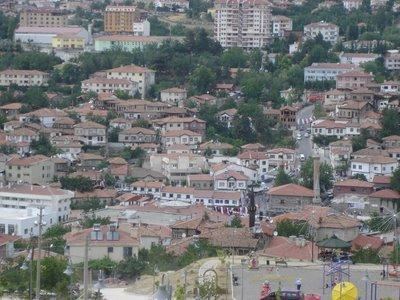
Ayaş is a town and district of Ankara Province in the Central Anatolia region of Turkey, 58 km from the city of Ankara which is very rich for historical monuments. According to 2000 census, population of the district is 21,239 of which 7,839 live in the urban center of Ayaş. The district covers an area of 1,112 km2 (429 sq mi), and the average elevation is 910 m (2,986 ft).
Contents
Map of Aya%C5%9F, Turkey
The district is known for its mulberry trees, its tasty tomatoes and its healing mineral water spas, both for drinking and bathing. There is an annual mulberry festival in the town of Ayaş.
The town has a long history and is mentioned in folk songs and the journals of the traveller Evliya Çelebi.
History
The citizens of Ayaş were Oghuz tribes as the village names Bayat, Afşar and Peçenek implies. In 1554, it became a sanjak center, and in 1864 it became a Kaza in Ankara Vilayeti. In Ottoman period, education was advanced in Ayaş. In 1900, there were eight medreses, two primary mekteps and one rüşdiye.