
Country Japan Phone number 0254-55-2111 Population 365 (Jun 2016) Prefecture Niigata Prefecture | District Iwafune Area 9.78 km² Local time Saturday 1:01 AM | |
 | ||
Region Chūbu (Kōshin'etsu) (Hokuriku) Time zone Japan Standard Time (UTC+9) Address 1513-11 Hinomiyama, Awashimaura-mura, Iwafune-gun, Niigata-ken 959-3265 Weather 3°C, Wind W at 14 km/h, 64% Humidity | ||
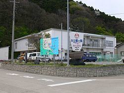
Awashimaura (粟島浦村, Awashimaura-mura) is a village located in Iwafune District, Niigata Prefecture, in the Hokuriku region of Japan. As of 1 June 2016, the village had an estimated population of 365 and a population density of 37.3 persons per km². Its total area was 9.78 square kilometres (3.78 sq mi).
Contents
Map of Awashimaura, Iwafune District, Niigata Prefecture, Japan
Geography
The village is located on Awashima Island, located in the Sea of Japan off the coast of Murakami, Niigata, to which it is connected by ferry.
History
The island of Awashima has been inhabited since prehistoric times, and fragments of Jomon period pottery have been found. During the Edo period, the island pasted between Murakami Domain, Shonai Domain and direct control by the Tokugawa Shogunate several times. During the Boshin War, the Schnell brothers offloaded weapons for Shonai Domain at Awashima. After the Meiji restoration, the village of Asahimaura was created in 1909 as part of Iwafune, District, Niigata Prefecture. The epicentre of the 1964 Niigata earthquake was near Awashima, and many of the buildings in Awashimaura were damaged or destroyed.
Economy
The main industries of Awashimaura are seasonal tourism and commercial fishing.