
Country United States ZIP code 85323, 85392 Population 78,822 (2013) | Elevation 974 ft (297 m) Local time Friday 7:24 AM | |
 | ||
Weather 11°C, Wind NE at 14 km/h, 45% Humidity Colleges and Universities Estrella Mountain Communi, Universal Technical Institute, Universal Technical Institute o, Maricopa Beauty College L, SouthWest Skill Center | ||
City of avondale arizona collaborating for the greater good
Avondale is a city in Maricopa County, Arizona, United States, adjacent to Phoenix, Arizona. According to the 2010 census, the population of the city is 76,238.
Contents
- City of avondale arizona collaborating for the greater good
- Map of Avondale AZ USA
- Geography
- Demographics
- Governmental representation
- Notable people
- Education
- Climate
- Sports
- Avondale parks
- References
Map of Avondale, AZ, USA
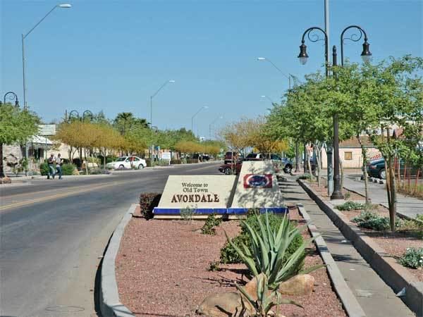
Avondale, incorporated in 1946, experienced rapid residential and commercial growth in the years since 1980. Once primarily a sparsely populated farming community with many acres of alfalfa and cotton fields, Avondale has transformed into a major bedroom suburb for Phoenix. Several major residential subdivisions and shopping centers have recently been built on former farmland, many adjacent to Interstate 10.
Phoenix Children's Hospital opened a satellite facility (the Southwest Valley Urgent Care Center), at the corner of Avondale Boulevard and McDowell Road in the spring of 2013. Avondale's main arterial streets leading into the city of Phoenix, including Van Buren Street and McDowell Road, have been widened and modernized to a more "suburban" and less "rural" appearance and function.
Geography
Avondale is located at 33°26′01″N 112°20′59″W (33.435322, -112.349758).
According to the United States Census Bureau, the city has a total area of 41.3 square miles (107 km2), of which, 41.3 square miles (107 km2) of it is land and 0.1 square miles (0.26 km2) of it (0.15%) is water.
Demographics
As of the census of 2000, there were 35,883 people, 10,640 households, and 8,724 families residing in the city. The population density was 869.7 people per square mile (335.8/km²). There were 11,419 housing units at an average density of 276.8 per square mile (106.9/km²). The racial makeup of the city was 63.27% White, 5.20% Black or African American, 1.28% Native American, 1.89% Asian, 0.14% Pacific Islander, 24.32% from other races, and 3.89% from two or more races. 46.23% of the population were Hispanic or Latino of any race.
There were 10,640 households out of which 47.9% had children under the age of 18 living with them, 62.9% were married couples living together, 12.7% had a female householder with no husband present, and 18.0% were non-families. 12.9% of all households were made up of individuals and 3.1% had someone living alone who was 65 years of age. The average household size was 3.36 and the average family size was 3.66.
In the city, the population was spread out with 34.2% under the age of 18, 9.7% from 18 to 24, 33.1% from 25 to 44, 17.7% from 45 to 64, and 5.3% who were 65 years of age or older. The median age was 29 years. For every 100 females there were 102.4 males. For every 100 females age 18 and over, there were 101.1 males.
The median income for a household in the city was $49,153, and the median income for a family was $51,084. Males had a median income of $35,134 versus $27,487 for females. The per capita income for the city was $16,919. About 10.3% of families and 13.8% of the population were below the poverty line, including 17.2% of those under age 18 and 16.7% of those age 65 or over.
In 2010 Avondale had a population of 78,256. The racial and ethnic composition of the population was 50.3% Hispanic or Latino, 34.0% non-Hispanic white, 9.3% black or African American, 1.7% Native American, 3.5% Asian, 0.4% Pacific Islander, 0.2% non-Hispanic of some other race and 4.5% reporting two or more races.
Governmental representation
Avondale falls within Arizona’s 3rd Congressional District, served by Representative Raúl Grijalva and Arizona’s 19th State Legislative District, served by Representatives Mark A. Cardenas and Diego Espinoza and Senator Lupe Contreras, all Democrats.
Notable people
Education
Avondale is served by the Littleton Elementary District, the Avondale Elementary District, and the Agua Fria Union High School District. Westview High School, La Joya Community High School, and Agua Fria High School are the high schools in the city.
Climate
This area has a large amount of sunshine year round due to its stable descending air and high pressure. According to the Köppen Climate Classification system, Avondale has a Hot desert climate, abbreviated "Bwh" on climate maps.
Sports
Avondale is home to Phoenix International Raceway. It holds two NASCAR Sprint Cup Series, two Xfinity Series and a Camping World Truck Series races annually.
The City of Avondale Parks and Recreation Department offers quality sports for both youth and adults.
Avondale parks
12421 W Lower Buckeye Road
101 E. Lower Buckeye
10857 West Pima St.
12325 West McDowell
201 E Mountain View Drive
521 E Western Ave
101 E Lawrence Blvd
351 E Western Ave
202 E Main St
104 W Western Ave