
Type Natural Max. width .20 mi (0.32 km) Length 970 m | Primary outflows Avalanche Creek Max. length .60 mi (0.97 km) Surface elevation 1,190 m Width 300 m | |
 | ||
Similar Glacier National Park, Trail of the Cedars, Highline Trail, Logan Pass, Grinnell Glacier | ||
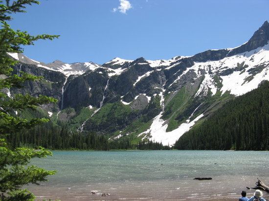
Avalanche Lake is located in Glacier National Park, in the U. S. state of Montana. Avalanche Lake is southwest of Bearhat Mountain and receives meltwater from Sperry Glacier. Avalanche Lake is a 2 miles (3.2 km) hike from the trailhead along the Trail of the Cedars.
Map of Avalanche Lake, Montana 59936, USA
References
Avalanche Lake (Flathead County, Montana) Wikipedia(Text) CC BY-SA