
Area 3.21 km² | Region Normandy Canton Caen-2 Population (2010) 1,394 Local time Friday 1:26 AM | |
 | ||
Weather 6°C, Wind SE at 13 km/h, 81% Humidity | ||
Authie is a French commune in the Calvados department in the Normandy region of north-western France.
Contents
- Map of Authie France
- Geography
- Toponymy
- History
- Administration
- Twinning
- Demography
- Civil heritage
- Religious heritage
- References
Map of Authie, France
The inhabitants of the commune are known as Althavillais or Althavillaises.
The commune has been awarded one flower by the National Council of Towns and Villages in Bloom in the Competition of cities and villages in Bloom.
Geography
Authie is located some 6 km (4 mi) north-west of the centre of Caen. Access to the commune is by road D220 from Villons-les-Buissons in the north-east which passes through the centre of the commune and the village and continues to Carpiquet in the south. The D220C also goes south-east from the village to the urban area of Caen. There are also the hamlets of Hameau de Saint-Louet, Franqueville, Fermie du Calvaire, and Cussy in the commune. Apart from the large residential area the commune is entirely farmland.
Toponymy
The name of the town is attested in the forms Alteium in 1227 and Auteya in 1264.
Albert Dauzat matched Authie with Authie in Somme department (Altegiam 830) on the coastal river Authie (Alteia 723) and considers it primarily as a hydronym but does not provide any further explanation.
According to René Lepelley this toponym is based on the pre-Celtic element alt in an unknown sense and is close to Authou in Pont-Authou.
François de Beaurepaire sees a Gallic (Celtic) element in the alt in Authou.
The Gallic term Attegia was recognized by Xavier Delamarre in Atheist-type names - e.g. Athis in the sense of "cabin or hut".
This analyses to ad- (pre-verb) and tegia meaning "house" (cf. Old Irish teg, old Welsh tig, Welsh Ty, Old Breton tig, and Breton ti all meaning "house").
It is likely that Authie contains the same element tegia preceded by another prefix. From a phonetic point of view there is a palatalization of the intervocalic consonant where [g] becomes [j] and then an Amuïssement or attenuation of [j]>[∅], a recurrent phenomenon in phonetics.
The same author explains that Arthies (Artegiae 680) may come from *Are-tegia which is a possible solution for Authie, knowing that [r] regularly becomes [l] before a consonant.
The name Altavilla is either a medieval romanization of a place named Hauteville as in Hauteville in Manche department and therefore does not relate to Authie. It may be a scribal error for *Alteia Villa or *Villa Alteia which mentions a villa, i.e. a rural area in medieval Latin, in a place called Alteia which is Authie.
History
In 1832 Authie (466 inhabitants in 1831) absorbed Saint-Louet-près-Authie (9 people) in the west of its territory.
The commune was liberated on 8 June 1944 but was largely destroyed in the bombing.
Administration
List of Successive Mayors
(Not all data is known)
Twinning
Authie has twinning associations with:
Demography
In 2010 the commune had 1,394 inhabitants. The evolution of the number of inhabitants is known from the population censuses conducted in the commune since 1793. From the 21st century, a census of communes with fewer than 10,000 inhabitants is held every five years, unlike larger communes that have a sample survey every year.
Sources : Ldh/EHESS/Cassini until 1962, INSEE database from 1968 (population without double counting and municipal population from 2006)
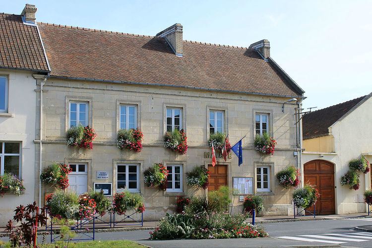
Civil heritage
The commune has one site that is registered as an historical monument:
Religious heritage
The commune has two religious buildings and structures that are registered as historical monuments:
The Church contains one item that is registered as an historical object: