
Country United States County Shawnee FIPS code 20-03250 Elevation 330 m Zip code 66402 Local time Wednesday 3:34 AM | Time zone CST (UTC-6) GNIS ID 0479054 Area 166 ha Population 1,226 (2013) Area code 785 | |
 | ||
Weather 4°C, Wind W at 24 km/h, 75% Humidity | ||
Auburn is a city in Shawnee County, Kansas, United States. As of the 2010 census, the city population was 1,227.
Contents
- Map of Auburn KS 66402 USA
- 19th century
- 20th century
- 21st century
- Geography
- Climate
- Demographics
- 2010 census
- 2000 census
- In popular culture
- Notable people
- References
Map of Auburn, KS 66402, USA
19th century
In July 1854, John W. Brown came to this area and found it highly suitable for a homestead. He acquired 800 acres (3.2 km2) through bartering with local Indians. He built a large brick farmhouse and later returned home to Missouri to tell his family and friends about the area. Some returned with him. In 1856, Mr. Brown along with M. C. Dickey, Loring Farnsworth and Henry Fox pre-empted 320 acres (1.3 km2) for the purpose of a town. They christened it Brownsville, although the name was changed in the 1860s due to the fact there was another city with the same name. This was before the introduction of postal codes. It was located on the California Road and work began at once on the many buildings needed in a town of Brownsville's size. Two daily stage lines brought mail and people to the town and business was very good.
Robert Simmerwell was a missionary to the Indians in Auburn. He originally served as a missionary among the Pottawatomie Indians in Michigan Territory, while he apprenticed to a blacksmith and attended school at night. He later came to the Baptist Shawnee Mission on Pottawatomie Creek in eastern Kansas. In 1848 the government set up a new mission a few miles west of Topeka. In a three-story stone building with twelve rooms, boys and girls were given instruction in the manual arts, as well as in reading, writing, arithmetic, and religious subjects. In the fall of 1854, he and his wife had retired from active work in the Pottawatomie Mission, to homestead on 160 acres (0.6 km2)southwest of the town.
In the 1850s, the city grew fast, and was often referred to as a "boom town". It was one of the largest in the state, and nearly became the state capital. However, Auburn was cast aside as an option, as the railroad bypassed the city. Topeka was chosen to be the capital because it had the railroad and an important ferry site along the Kansas River. The population dwindled, but continued to hover around 100 for many decades.
20th century
A description of the town from a 1912 volume of Kansas: A Cyclopedia of State History is as follows:
Auburn, a money order post office of Shawnee county, is in the township of the same name, about 15 miles (24 km) southwest of Topeka and 8 miles (13 km) west of Wakarusa, which is the nearest railroad station. It is a trading center for that section of the county, has Baptist, Methodist and Presbyterian churches, telephone connection with Topeka and other adjacent points, and in 1910 reported a population of 72. Two rural free delivery routes start from the Auburn office and supply daily mail to the farmers of the vicinity.
Auburn finally began to grow in population in the 1950s. An important issue at this time was the city's small school system. It consisted of Auburn Grade School (grades K-5) and Auburn High School (grades 6-12). The Highschool was quickly becoming overcrowded, and in the late 1950s, a new building was built. However, it was eventually decided that the Auburn School district would merge with the Washburn School District to increase efficiency. The last class graduated from Auburn High in 1966. The high school became Auburn Middle School, and in the late 1980s closed and converted to a community center, and the grade school remains open to this day.
In the 1960s and 1970s, the city's population shrank, but was re-vitalized with a large housing project. Between 1975 and 1985, roughly 100 new split-level homes were built. Since then, many more have sprung up.
21st century
During the years of 2000-2006, a 10-acre (40,000 m2) pasture on the northeast side of Auburn was developed. A retirement home and three small, two-story apartment complexes have been built, resulting in the creation of residences for around 100 people.
In October 2009, held its 100th annual Grange Fair, which originally was originally started as the Shawnee County Free Fair in 1909.
The city Founder John W. Brown's historic farmhouse and the surrounding land sit 3/4 miles southwest of city limits on a gravel road. Research conducted by the state historical society states it may be the oldest standing building in Shawnee County. However, it is not an official historical site. The property is privately owned, is 305 acres (1.23 km2) in size and produces row crops.
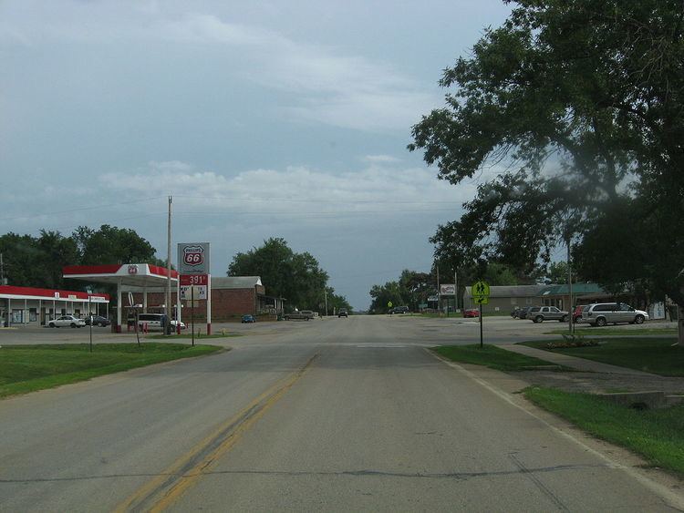
The city itself contains several businesses. There is a BP gas station, a full-service Vicker's gas station, a law office, a dentist, a veterinary clinic, a chiropractor, a pizza parlor, a liquor store, a Dollar General (which opened in late 2009), and an upper-end used car dealership as well as others. Most Auburn residents commute to other surrounding cities for work, often Topeka. Currently, there are four churches in Auburn: Presbyterian, Christian, Methodist and Baptist. The Auburn Community Center houses a community library. Many people in Auburn also belong to groups such as the Kiwanis Club, The Lyons Club, the Boy Scout troop, the Baseball Association. There is also a currently inactive Masonic Lodge.
Auburn has four police officers, two patrol cars, and a fully equipped volunteer fire department. There is also a road maintenance and utilities department.
Geography
Auburn is located at 38°54′24″N 95°49′0″W (38.906709, -95.816789). According to the United States Census Bureau, the city has a total area of 0.64 square miles (1.66 km2), all of it land.
Climate
The climate in this area is characterized by hot, humid summers and generally mild to cool winters. According to the Köppen Climate Classification system, Auburn has a humid subtropical climate, abbreviated "Cfa" on climate maps.
Demographics
Auburn is part of the Topeka, Kansas Metropolitan Statistical Area.
2010 census
As of the census of 2010, there were 1,227 people, 467 households, and 320 families residing in the city. The population density was 1,917.2 inhabitants per square mile (740.2/km2). There were 492 housing units at an average density of 768.8 per square mile (296.8/km2). The racial makeup of the city was 94.6% White, 0.6% African American, 0.4% Native American, 0.2% Asian, 0.1% Pacific Islander, 0.2% from other races, and 3.8% from two or more races. Hispanic or Latino of any race were 4.1% of the population.
There were 467 households of which 42.2% had children under the age of 18 living with them, 49.3% were married couples living together, 13.9% had a female householder with no husband present, 5.4% had a male householder with no wife present, and 31.5% were non-families. 28.9% of all households were made up of individuals and 14.6% had someone living alone who was 65 years of age or older. The average household size was 2.63 and the average family size was 3.28.
The median age in the city was 33 years. 32.4% of residents were under the age of 18; 7% were between the ages of 18 and 24; 26.5% were from 25 to 44; 22.5% were from 45 to 64; and 11.5% were 65 years of age or older. The gender makeup of the city was 47.6% male and 52.4% female.
2000 census
As of the census of 2000, there were 1,121 people, 385 households, and 301 families residing in the city. The population density was 1,920.5 people per square mile (746.2/km²). There were 400 housing units at an average density of 685.3 per square mile (266.3/km²). The racial makeup of the city was 95.63% White, 0.18% African American, 0.89% Native American, 0.36% Asian, 0.36% from other races, and 2.59% from two or more races. Hispanic or Latino of any race were 3.84% of the population.
There were 385 households out of which 50.4% had children under the age of 18 living with them, 62.6% were married couples living together, 12.7% had a female householder with no husband present, and 21.6% were non-families. 17.7% of all households were made up of individuals and 8.8% had someone living alone who was 65 years of age or older. The average household size was 2.91 and the average family size was 3.34.
In the city, the population was spread out with 34.8% under the age of 18, 7.9% from 18 to 24, 31.9% from 25 to 44, 17.3% from 45 to 64, and 8.1% who were 65 years of age or older. The median age was 30 years. For every 100 females there were 90.6 males. For every 100 females age 18 and over, there were 84.1 males.
The median income for a household in the city was $42,632, and the median income for a family was $44,934. Males had a median income of $31,699 versus $22,222 for females. The per capita income for the city was $15,679. About 2.3% of families and 3.4% of the population were below the poverty line, including 3.9% of those under age 18 and 4.5% of those age 65 or over.
In popular culture
Auburn is the hometown of Cameron Mitchell, a fictional character in the science fiction television series Stargate SG-1, though, the episode showed Auburn as having a population of 21,211.