
Country United States County Clinton FIPS code 36-03221 Elevation 237 m Local time Wednesday 3:41 AM | State New York Time zone Eastern (EST) (UTC-5) GNIS feature ID 0978699 Population 3,146 (2010) | |
 | ||
Weather 9°C, Wind S at 14 km/h, 75% Humidity Area 113.7 km² (101.3 km² Land / 12.17 km² Water) | ||
Au Sable, or Ausable, is a town in Clinton County, New York, United States. The population was 3,146 at the 2010 census. The name is from the Ausable River that flows through the town and means "at the sand".
Contents
Map of Au Sable, NY, USA
The town is in the southeast corner of the county, south of Plattsburgh.
History
The land was first settled around 1795. The town was formed from part of the town of Peru in 1839. Mining was an important early industry in the town.
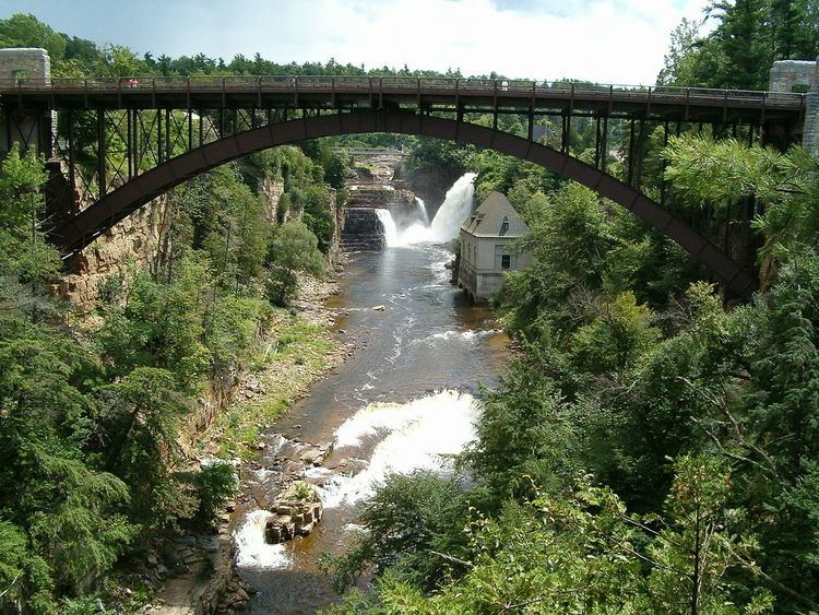
The AuSable Chasm Bridge was built in 1932-1933.
Geography
According to the United States Census Bureau, the town has a total area of 43.9 square miles (113.6 km2), of which 39.1 square miles (101.3 km2) is land and 4.7 square miles (12.3 km2), or 10.81%, is water.
The town is bordered by Lake Champlain to the east. The south town line is the border of Essex County.
Ausable Chasm, a popular tourist location on the Ausable River, is along the southeast border of the town.
Interstate 87, the Adirondack Northway, is an important north-south highway in Ausable, with access to the town from Exit 34 (Route 9N). U.S. Route 9 runs closer to Lake Champlain than the Northway. New York State Route 9N runs east-west along the south town line, joining US 9 in Keesville. New York State Route 22 is a north-south highway mostly lying west of the Northway.
Demographics
As of the census of 2000, there were 3,015 people, 1,180 households, and 831 families residing in the town. The population density was 77.1 people per square mile (29.8/km²). There were 1,347 housing units at an average density of 34.4 per square mile (13.3/km²). The racial makeup of the town was 97.78% White, 0.80% African American, 0.23% Native American, 0.30% Asian, 0.27% from other races, and 0.63% from two or more races. Hispanic or Latino of any race were 1.33% of the population.
There were 1,180 households out of which 33.2% had children under the age of 18 living with them, 53.7% were married couples living together, 11.6% had a female householder with no husband present, and 29.5% were non-families. 23.6% of all households were made up of individuals and 12.1% had someone living alone who was 65 years of age or older. The average household size was 2.53 and the average family size was 2.95.
In the town, the population was spread out with 26.0% under the age of 18, 7.5% from 18 to 24, 29.1% from 25 to 44, 23.0% from 45 to 64, and 14.4% who were 65 years of age or older. The median age was 38 years. For every 100 females there were 97.4 males. For every 100 females age 18 and over, there were 92.0 males.
The median income for a household in the town was $34,118, and the median income for a family was $39,906. Males had a median income of $30,213 versus $22,933 for females. The per capita income for the town was $15,789. About 7.7% of families and 12.0% of the population were below the poverty line, including 16.9% of those under age 18 and 14.7% of those age 65 or over.