
OS grid reference SP767499 Country England Post town Northampton Shire county Northamptonshire Dialling code 01604 | Region East Midlands Sovereign state United Kingdom Local time Sunday 3:58 PM District South Northamptonshire UK parliament constituency Northampton South | |
 | ||
Population 389 (2001 Census)
395 (2011). Weather 11°C, Wind S at 32 km/h, 80% Humidity | ||
Ashton is a village in South Northamptonshire about 1 mile (1.6 km) southeast of Roade village close to the Northampton to Milton Keynes A508, ca.3 miles (5 km) south of junction 15 of the M1 motorway, 6 miles (10 km) south of Northampton and 11 miles (18 km) north of Milton Keynes. The population of the civil parish at the 2011 census was 395. The village is about 67 miles (107.8 km) north of London via the M1 junction 15. The West Coast Main Line intersects the village on its eastern side.
Contents
Map of Ashton, UK
Governance
The village has a Parish Council and the Ashton website publishes name of councilors and their proceedings.
Notable buildings
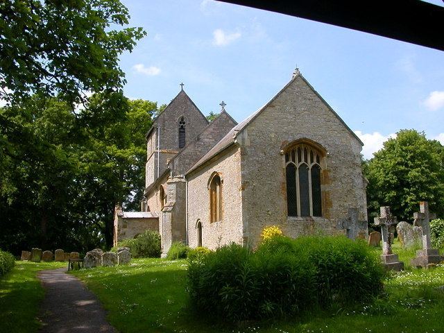
The church is dedicated to St Michael with the oldest parts 13th and 14th century. It was extensively restored in 1895. There are various monuments:
The popular pub the Old Crown Inn, on Stoke Road also serves meals.
The village has a single Church of England primary school: Ashton C of E Primary School.