
Country United States County Alameda FIPS code 06-02980 Elevation 13 m Zip code 94541 Area code Area code 510 | State California Time zone Pacific (PST) (UTC-8) GNIS feature IDs 1657955, 2407773 Area 4.76 km² Population 21,925 (2010) | |
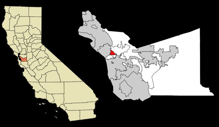 | ||
Ashland (formerly, San Leandro South) is a census-designated place (CDP) in Alameda County, California, United States. The population was 21,925 at the 2010 census.
Contents
Map of Ashland, CA, USA
Geography
According to the United States Census Bureau, the CDP has a total area of 1.8 square miles (4.7 km2), all of it land.
History
Ashland developed in the 1940s. It was named for an Oregon ash tree.
2010
The 2010 United States Census reported that Ashland had a population of 21,925. The population density was 11,926.7 people per square mile (4,604.9/km²). The racial makeup of Ashland was 6,705 (30.6%) White, 4,269 (19.5%) African American, 232 (1.1%) Native American, 4,031 (18.4%) Asian, 260 (1.2%) Pacific Islander, 5,124 (23.4%) from other races, and 1,304 (5.9%) from two or more races. Hispanic or Latino of any race were 9,394 persons (42.8%).
The Census reported that 21,739 people (99.2% of the population) lived in households, 103 (0.5%) lived in non-institutionalized group quarters, and 83 (0.4%) were institutionalized.
There were 7,270 households, out of which 3,209 (44.1%) had children under the age of 18 living in them, 2,786 (38.3%) were opposite-sex married couples living together, 1,589 (21.9%) had a female householder with no husband present, 635 (8.7%) had a male householder with no wife present. There were 639 (8.8%) unmarried opposite-sex partnerships, and 54 (0.7%) same-sex married couples or partnerships. 1,713 households (23.6%) were made up of individuals and 417 (5.7%) had someone living alone who was 65 years of age or older. The average household size was 2.99. There were 5,010 families (68.9% of all households); the average family size was 3.52.
The population was spread out with 6,097 people (27.8%) under the age of 18, 2,317 people (10.6%) aged 18 to 24, 6,938 people (31.6%) aged 25 to 44, 4,905 people (22.4%) aged 45 to 64, and 1,668 people (7.6%) who were 65 years of age or older. The median age was 31.4 years. For every 100 females there were 95.2 males. For every 100 females age 18 and over, there were 91.3 males.
There were 7,758 housing units at an average density of 4,220.2 per square mile (1,629.4/km²), of which 2,510 (34.5%) were owner-occupied, and 4,760 (65.5%) were occupied by renters. The homeowner vacancy rate was 2.5%; the rental vacancy rate was 4.5%. 7,883 people (36.0% of the population) lived in owner-occupied housing units and 13,856 people (63.2%) lived in rental housing units.
2000
As of the census of 2000, there were 20,793 people, 7,223 households, and 4,868 families residing in the CDP. The population density was 11,284.9 people per square mile (4,363.2/km²). There were 7,372 housing units at an average density of 4,001.0 per square mile (1,546.9/km²). The racial makeup of the CDP in 2010 was 15.6% non-Hispanic White, 18.6% non-Hispanic Black or African American, 0.4% Native American, 18.1% Asian, 1.1% Pacific Islander, 0.3% from other races, and 3.1% from two or more races. 42.8% of the population were Hispanic or Latino of any race.
There were 7,223 households out of which 40.0% had children under the age of 18 living with them, 39.7% were married couples living together, 20.5% had a female householder with no husband present, and 32.6% were non-families. 24.3% of all households were made up of individuals and 6.8% had someone living alone who was 65 years of age or older. The average household size was 2.83 and the average family size was 3.39.
In the CDP, the population was spread out with 28.5% under the age of 18, 10.0% from 18 to 24, 35.1% from 25 to 44, 17.3% from 45 to 64, and 9.1% who were 65 years of age or older. The median age was 31 years. For every 100 females there were 95.8 males. For every 100 females age 18 and over, there were 91.7 males.
The median income for a household in the CDP was $40,811, and the median income for a family was $43,202. Males had a median income of $33,943 versus $31,092 for females. The per capita income for the CDP was $18,134. About 11.9% of families and 14.3% of the population were below the poverty line, including 19.9% of those under age 18 and 11.1% of those age 65 or over.
Government
Ashland is an unincorporated community and thus is governed directly by Alameda County. The area is policed by the Alameda County Sheriff's Office and the California Highway Patrol. Incorporation as a city in the future remains a possibility.