
Population 219 (2011 Census) Sovereign state United Kingdom Local time Sunday 1:48 PM | OS grid reference TM210627 Post town IPSWICH Dialling code 01728 | |
 | ||
Weather 13°C, Wind SW at 32 km/h, 71% Humidity UK parliament constituency Central Suffolk and North Ipswich | ||
Ashfield cum Thorpe is a village and civil parish in the Mid Suffolk district of Suffolk, England, between the town of Framlingham to the East and the village of Debenham to the West.
Map of Ashfield cum Thorpe, UK
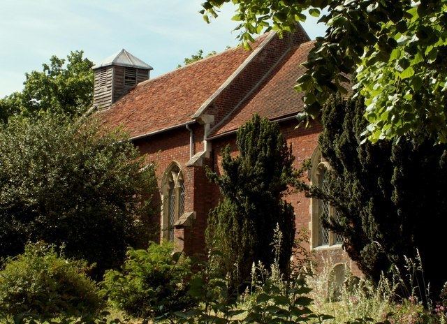
It is of Anglo-Saxon origin and is mentioned in the Domesday Book, when it had a population of around 45 adult men (and total population probably similar to the current figure). It has a church and a village hall, and used to have a school, a pub and two shops. Some of the houses in the village date back to the 15th century.
The name "Ashfield cum Thorpe" (Ashfield with Thorpe) refers to the civil parish, which consists of the village of Ashfield and the nearby hamlet of Thorpe. The church of St Mary existed in Ashfield at the time of the Domesday Book, and at some time after, St Peter's church was built at Thorpe. This latter fell into ruins by around 1600, and the church at Ashfield was used by both sets of villagers. Thorpe church was rebuilt in 1739, retaining its late Saxon tower. By the late 18th Century, Ashfield church was in disrepair, and it was the turn of Ashfield villages to use Thorpe church. This went on until 1853, when Lord Henniker of Thornham Magna paid for a new St Mary church in Ashfield. Alas, Thorpe church is now in ruins, only part of the tower remaining.
Nearby villages include Earl Soham, Monk Soham, Kenton. Debenham and Framsden.