
Length 164 km Basin area 3,860 km² | Basin size 3,860 km (1,490 sq mi) Discharge 65 m³/s Source elevation 2,400 m | |
 | ||
Progression Garonne→ Atlantic Ocean | ||
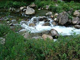
The Ariège (Occitan: Arièja, Catalan: Arieja) is a 164 km long river in southern France, right tributary of the Garonne. Its source is in the Pyrenees, where it forms part of the border with Andorra. It flows north through the following départements and towns:
Map of L'Ari%C3%A8ge, Cintegabelle, France
It flows into the Garonne in Portet-sur-Garonne, south of Toulouse. If the Latin origin of its name (Aurigera) is to be trusted, the Ariège is supposed to carry gold nuggets.
References
Ariège (river) Wikipedia(Text) CC BY-SA