
 | ||
The Arctic Satellite Composite Project, a grant funded by the Arctic Sciences division of the National Science Foundation (NSF), is a project dedicated to developing satellite composite images, of various wavelengths, over the Arctic polar region of the globe. The project, based out of the Space Science and Engineering Center (SSEC) at the University of Wisconsin, is headed by Principal Investigator (PI) Dr. Matthew Lazzara, with assistance from co-PI Shelley Knuth.
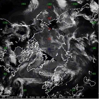
Since the project’s inception in 2007, composite images in the infrared, water vapor, short-wave, and long-wave wavelengths have been generated over the region. The images are produced every three hours, on the synoptic hour. To generate the composite images, swaths of satellite images from geo-stationary and polar-orbiting satellites are collected within +/- 50 minutes of the top of the hour, and “spliced” together to form one image of the entire region. The images are centered at the North Pole, and extend as far south as 45°. The images have a resolution of 5 km.
The Arctic satellite composites have already been used in their earliest form to support studies of Arctic pollution. They have been used operationally to support the polar study using aircraft, remote sensing, surface measurements and models of climate, chemistry, aerosols and transport (POLARCAT), and Arctic research of the composition of the troposphere from aircraft and satellites (ARCTAS) campaigns during the International Polar Year.
Future work on the generation of the satellite composite imagery will include visible composite generation as well as hourly composite generation. It is anticipated this work will be completed in 2010.