
 | ||
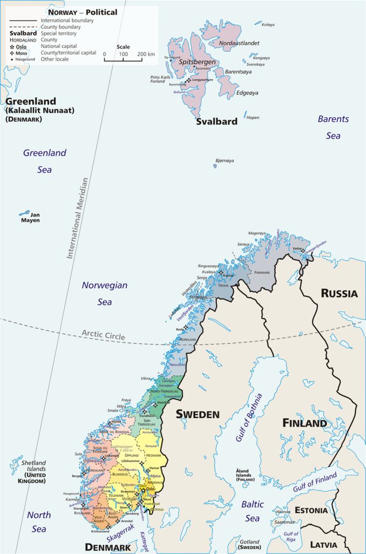
Arctic Norway (Norwegian: Det arktiske Norge) comprises the northernmost parts of Norway that lie above the Arctic circle. Norway, being one of the most stretched-out countries in the world, reaches from approximately 58°N to 81°N, so large parts lie north of the Arctic circle at 66°33′.
Geography
Arctic Norway consists of four geographically separated parts:
The Arctic circle crosses mainland Norway at Saltfjellet, which separates Helgeland from the northern part of Nordland county. Thus about half of the county lies north of the Arctic circle, along with the whole of Troms and Finnmark counties. The total area of mainland Norway above the Arctic circle is ca. 95,000 km2 (37,000 sq mi). The population is about 393,000, which makes this the most populated arctic region in the world.
Svalbard archipelago is situated some 640 km (400 mi) north of mainland Norway and has an area of 61,000 km2 (24,000 sq mi). The population is about 2,400, and includes Longyearbyen, the northernmost town in the world.
Bear Island (Norwegian: Bjørnøya) is situated some 400 kilometres (250 mi) north of mainland Norway, about two-thirds the distance to Svalbard. It has an area of 178 km2 (69 sq mi). The population is 9, which is the staff of the weather station.
Jan Mayen is situated some 880 km northwest of mainland Norway and about 450 km off the coast of Greenland. It has an area of 373 km2. The population is 18, which is the staff of the weather station.