
Country United States ZIP codes 63432, 63442 Elevation 208 m Population 42 (2013) Area code 660 | Time zone Central (CST) (UTC-6) FIPS code 29-01576 Area 23 ha Local time Tuesday 12:19 AM | |
 | ||
Weather 11°C, Wind S at 16 km/h, 64% Humidity | ||
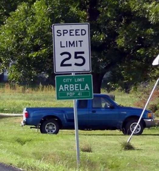
Arbela is a village in Scotland County, Missouri, United States. The population was 41 at the 2010 census.
Contents
Map of Arbela, MO 63432, USA
History
Arbela was originally named "North Perryville", and under the latter name was platted in 1858. With the coming of the Keokuk & Western Railroad some years later, the town was resurveyed and the present name chosen.
Geography
Arbela is located at 40°27′43″N 92°0′58″W (40.461923, -92.016131). According to the United States Census Bureau, the village has a total area of 0.09 square miles (0.23 km2), all of it land.
2010 census
As of the census of 2010, there were 41 people, 20 households, and 13 families residing in the village. The population density was 455.6 inhabitants per square mile (175.9/km2). There were 25 housing units at an average density of 277.8 per square mile (107.3/km2). The racial makeup of the village was 97.6% White and 2.4% from other races. Hispanic or Latino of any race were 2.4% of the population.
There were 20 households of which 20.0% had children under the age of 18 living with them, 50.0% were married couples living together, 15.0% had a female householder with no husband present, and 35.0% were non-families. 25.0% of all households were made up of individuals and 5% had someone living alone who was 65 years of age or older. The average household size was 2.05 and the average family size was 2.23.
The median age in the village was 49.5 years. 17.1% of residents were under the age of 18; 0% were between the ages of 18 and 24; 24.4% were from 25 to 44; 39.1% were from 45 to 64; and 19.5% were 65 years of age or older. The gender makeup of the village was 46.3% male and 53.7% female.
2000 census
As of the census of 2000, there were 40 people, 17 households, and 13 families residing in the town. The population density was 451.1 people per square mile (171.6/km²). There were 20 housing units at an average density of 225.6/sq mi (85.8/km²). The racial makeup of the town was 100.00% White.
There were 17 households out of which 29.4% had children under the age of 18 living with them, 47.1% were married couples living together, and 41.2% were non-families. 35.3% of all households were made up of individuals and 5.9% had someone living alone who was 65 years of age or older. The average household size was 2.35 and the average family size was 2.90.
In the town the population was spread out with 22.5% under the age of 18, 7.5% from 18 to 24, 37.5% from 25 to 44, 27.5% from 45 to 64, and 5.0% who were 65 years of age or older. The median age was 36 years. For every 100 females there were 150.0 males. For every 100 females age 18 and over, there were 121.4 males.
The median income for a household in the town was $31,250, and the median income for a family was $36,250. Males had a median income of $21,667 versus $13,750 for females. The per capita income for the town was $12,853. None of the families and 33.5% of the population were living below the poverty line, including no under eighteens and none of those over 64.