
Country Philippines Barangays Area 693.2 km² | Incorporated August 30, 1991 Time zone PST (UTC+8) Province Cotabato | |
 | ||
Region SOCCSKSARGEN (Region XII) District 2nd District of Cotabato Neighborhoods Badiangon, Balatukan, Binungan, Duldulumon, Datu Unot, Ulo Ugaga | ||
Arakan is a second class municipality in the province of Cotabato, Philippines. According to the 2015 census, it has a population of 48,228 people.
Contents
- Map of Arakan Cotabato Philippines
- History
- Barangays
- Demographics
- Tourist attractions
- Local government
- References
Map of Arakan, Cotabato, Philippines
History
The word Arakan is derived from the Manobo term “ara” which means abundance of natural resources in the valley and “kan” which means heroism, bravery and valor of the early Manobo leaders and settlers of the area. The word “arakan” then was named referring to one of the rivers of the valley. Arakan is basically a territory of a number of ethno-linguistic groups, predominantly of the Manobo-Kulamanon and Manobo-Tinananon tribes. The names of the two (2) big rivers in Arakan were also from these ethnic groups of the Kulaman and Tinanan Rivers. The original settlers of the place are the Manobos, which were believed to have originally come from the string of islands in the Malayan Peninsula and Borneo. This assumption is based on their language structure which has Malayan roots.
Throughout the years, they maintained contacts and inter-marriages with other tribes such as Matigsalogs and other lesser Bagobo tribes. The early migrant settlers from Visayas came in as early as the 1930s. Massive clearing of the forest areas became the order of these years for agricultural and settlement purposes. Due to these activities, the Manobos were forced to settle in the inner portions away from those areas occupied by the Bisayans. They were pushed further still and they permanently inhabited the highlands of the valley to avoid social and cultural interactions with the migrant Bisayans.
Early attempts to fully develop Arakan dated back in the 70’s when the late Mayor Froilan Matas of the Municipality of Magpet (mother municipality of Arakan) unified his efforts with the Sangguniang Bayan, which was ably supported by the barangay leaders, and its populace led by Greenfield (now Poblacion) Barangay Chairman Aproniano A. Ebon, Sr. through a resolution strongly manifesting its support to the creation of a separate municipality of Arakan. In 1972, a more unified attempts to create the municipality by the provincial leadership has led the passing of House Bill No. 4805 sponsored by the then Assemblyman Salipada K. Pendatun. The declaration of martial law in the same year deterred its creation. This did not however, dampen the hope of the great leaders of Magpet.
The EDSA Revolution that took place in 1986 paved way to another attempt of the creation of a separate and new municipality through the collaborative efforts of the municipal government of Magpet spearheaded by then Vice Mayor Aproniano A. Ebon, Sr., the provincial leadership headed by then Governor Rosario P. Diaz, M.D. and the most especially by the passage of a house bill sponsored by Congressman Gregorio A. Andolana of the Second District of Cotabato Province.
After five years, the Municipality of Arakan was finally created by virtue of Republic Act No. 7152, approved by President Corazon C. Aquino on August 30, 1991. Under the provision of the Act, it had to elect its new officials in local election on May 11, 1992. The then Vice Mayor Ebon overwhelmingly got the mandate as the first Municipal Mayor, while David B. Figura, Sr. was the first Vice Mayor. Honorable Ebon spent three terms as municipal mayor, as did David B. Figura, Sr. (who died before his last term ended).
Barangays
Arakan is politically subdivided into 28 barangays.
Demographics
In the 2015 census, the population of Arakan, Cotabato, was 48,228 people, with a density of 70 inhabitants per square kilometre or 180 inhabitants per square mile.
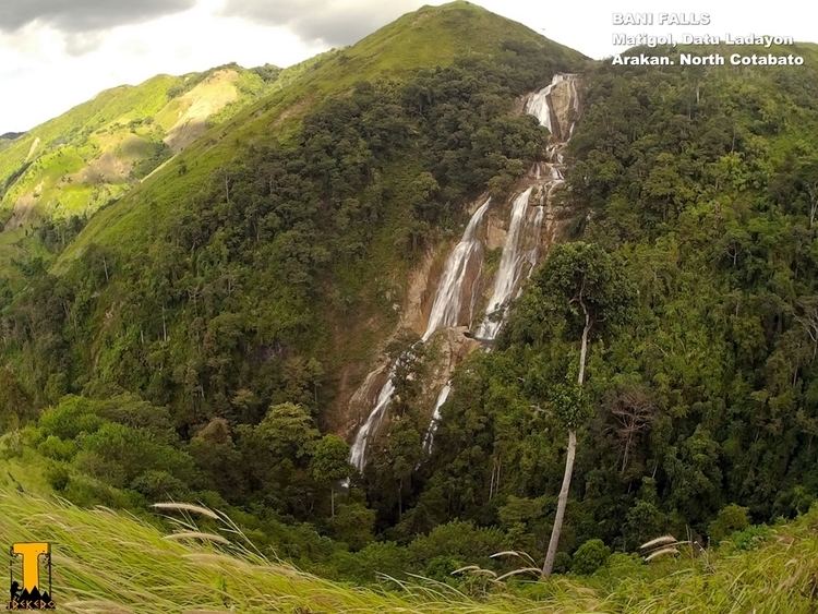
Tourist attractions
Local government
As of 2014 Gerardo Tuble Sr. is municipal mayor.