
Area 20.56 km² | Region Occitanie Canton Alzonne Population (2009) 426 Local time Tuesday 3:29 AM | |
 | ||
Weather 10°C, Wind NW at 8 km/h, 83% Humidity | ||
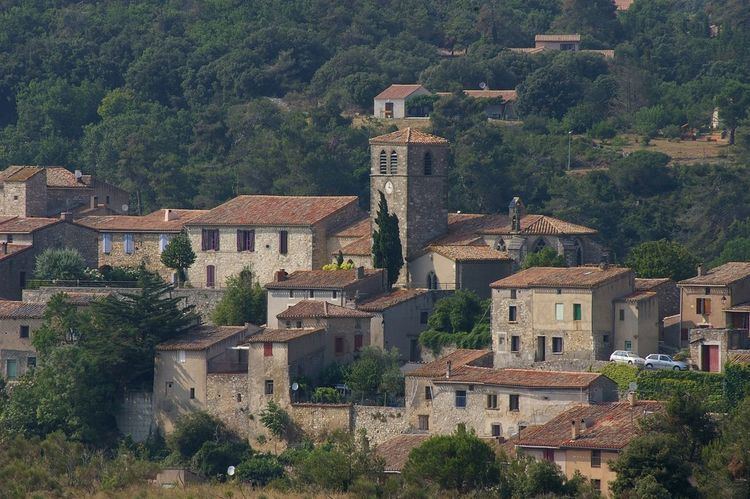
Aragon (Occitan: Argon) is a French commune in the Aude department in the Occitanie region of southern France.
Contents
- Map of 11600 Aragon France
- Geography
- Toponymy
- History
- Administration
- Demography
- Economy
- Civil heritage
- Religious heritage
- References
Map of 11600 Aragon, France
The inhabitants of the commune are known as Aragonais or Aragonaises
Geography
Aragon is a commune in the Carcassonne urban area on the Green Meridian in Cabardès. The village is built on a rocky outcrop overlooking the Trapel and Vallette streams.
The commune is located some 13 km north of Carcassonne and 6 km east of Montolieu. Access is by the D203 road from Fraisse-Cabardès in the north-west passing through the length of the commune to the village then continuing south to Pennautier. There is also the D935 going south-east from the village to Villegailhenc. The north of the commune is quite rugged and heavily forested while the south of the commune is farmland with some patches of forest.
The Ruisseau de Trapel flows from the north-west passing north of the village and gathering tributaries as it continues south-east to join the Canal du Midi south of Les Pradels. The Ruisseau de la Vallette also flows from further north-west to pass the village on the southern side before joining the Trapel. Numerous other streams rise in the south of the commune and flow south-east. In the north-east the Ruisseau de Vallouviere flows south-east and joins the Trapel south-east of the commune.
Toponymy
The town is also known as Aragon-en-Cabardès but this name is not so easy to use. The name could come from the Kingdom of Aragon and dates from the 11th century but some propose Celtic or Greco-Celtic origins meaning a place near a battle or near the wilderness.
Other Places: Champ du Saule, Clapier d'Amen, Clapier Rouge, l'Espinal, la Croix du Carabier, Larjale, le Malrégas, les Précieuses, Mont Feste, Mourrel de la Crose, Mourrel Redon, Pechicous, Plateau d'Aragon, and Pratjon.
History
There are remains from the Bronze Age (2000 BC) which were found in a cave. In 1820 a fragment with a Gallo-Roman funerary inscription was discovered.
In the 10th century Aragon belonged to the Abbey of Montolieu but, from the beginning of the 12th century, traces of the Lords of Aragon have been found. They then had large areas of land but they seem to have followed the Cathar cause. They were thus deprived of their property by the Inquisition although they received financial compensation. Their fief was then shared between the Royal Domain and the bishopric of Carcassonne but, even without the protection of lords, Catharism still survived in the village.
In 1575 and in 1588 the Huguenots occupied the village. The Viscount of Turenne recaptured it in 1580.
The village experienced a period of prosperity in the late 18th century when looms for supplying the clothiers at Carcassonne brought additional revenue to the community.
In the 17th century, the lordship of Aragon belonged to Sebastian de Maurel, whose daughter, Anne de Maurel d'Aragon, was married in 1726 at Aragon to Pierre de Bancalis, giving birth to the noble family Bancalis de Maurel d'Aragon.
Administration
List of Successive Mayors
(Not all data is known)
Demography
In 2009 the commune had 426 inhabitants. The evolution of the number of inhabitants is known from the population censuses conducted in the commune since 1793. From the 21st century, a census of communes with fewer than 10,000 inhabitants is held every five years, unlike larger towns that have a sample survey every year.
Sources : Ldh/EHESS/Cassini until 1962, INSEE database from 1968 (population without double counting and municipal population from 2006)
Economy
Aragon is part of the Cabardès AOC
Civil heritage
Religious heritage
Two sites are registered as historical monuments: