
Country Philippines Congr. district 1st district Barangays Area 204.3 km² Local time Tuesday 9:48 AM Province Palawan | Region MIMAROPA (Region IV-B) Formed 1961 Time zone PST (UTC+8) Population 14,113 (2010) Area code 48 Dialling code 48 | |
 | ||
Weather 28°C, Wind NE at 21 km/h, 70% Humidity | ||
Araceli is a fourth class municipality in the province of Palawan, Philippines. According to the 2010 census, it has a population of 14,113 people.
Contents
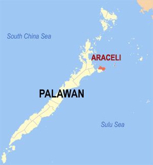
Map of Araceli, Philippines
The municipality covers roughly the northern half of Dumaran Island. Cuyono is the principal language of the area.
Araceli was formerly part of Dumaran Municipality, but was made into a separate municipality in 1961. The Catholic Parish is Nuestra Sra. de Araceli, that can be translated to "Altar of the Sky" (from ara, meaning altar; and celi, meaning sky).
Barangays
Araceli is politically subdivided into 13 barangays.
References
Araceli, Palawan Wikipedia(Text) CC BY-SA