
- elevation 750 m (2,461 ft) Area 10,635 km² Notification 1951 | - elevation 500 m (1,640 ft) | |
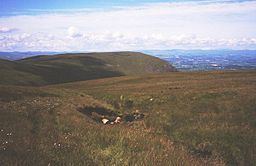 | ||
Appleby Fells is a Site of Special Scientific Interest in the Eden district of Cumbria near Appleby in Westmorland. The area is approximately a triangle with a right angle in the North East at Cow Green Reservoir. It extends westwards to near Knock, Cumbria and southwards to near Helbeck. The area overlaps the North Pennines AONB.
Natural England states that "the great importance of the area lies in its rich variety of habitats and associated plant and animal species" and that "geologically there are important exposures of the Great Whin Sill quartz dolerite". According to data from Natural England the condition of 93% of the SSSI is designated "Unfavourable Recovering" and less than 5% is "Favourable".
English Heritage data shows that the area includes nine scheduled ancient monuments including prehistoric stone hut circles, field systems, cairns, shielings, and a Romano-British farmstead. It also includes the Scordale Lead Mines.