
Surface area 31.9 km (12.3 sq mi) Length 6,000 m | Max. length 6 km (3.7 mi) Area 31.9 km² Max width 6,000 m | |
 | ||
Similar Karioi, Mount Pirongia, Bridal Veil Falls, Ngarunui Beach, Te Uku Wind Farm | ||
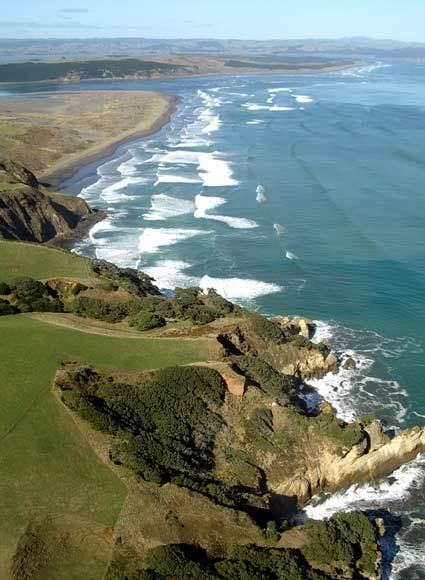
Aotea Harbour is the smallest of three large natural inlets in the Tasman Sea coast of the Waikato region of New Zealand's North Island. It is located between Raglan Harbour to the north and Kawhia Harbour to the south, 30 kilometres southwest of Hamilton. 54% of the area around the harbour is in sheep and beef grazing. Since 1850 native forest cover has declined from 98% to 28%, about 18% managed by the Department of Conservation.
Map of Aotea Harbour, New Zealand
Aotea Harbour is a drowned valley system following the post glacial Aranuian sea level rise of over 100m in the last 14,000 years, but its level may also be influenced by the Makomako and Te Maari faults. It has a high-tide area of 32 km2 (12 sq mi) and a low-tide area of 6 km2 (2.3 sq mi),
Bridal Veil Falls is located on Pakoka River, and Lake Disappear is on Pakihi Stream, both of which flow into Aotea Harbour.