
- location southeast of Medford - elevation 1,257 ft (383 m) Country United States of America | - elevation 4,643 ft (1,415 m) Mouth Little Butte Creek | |
 | ||
- location downstream of Eagle Point | ||
Antelope Creek is a tributary of Little Butte Creek in the U.S. state of Oregon. It begins in the foothills of the Cascade Range southeast of Medford and flows generally northwest to meet the larger creek downstream of Eagle Point and about 3 miles (5 km) by water from Little Butte Creek's mouth on the Rogue River.
Contents
Map of Antelope Creek, Oregon, USA
The creek passes under Oregon Route 62 (Crater Lake Highway) between Eagle Point and White City, slightly before entering Little Butte Creek. Named tributaries of Antelope Creek from source to mouth are Yankee Creek, Quarter Branch, and Dry Creek.
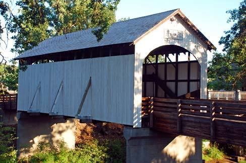
Covered bridge
Antelope Creek Bridge, a covered bridge, formerly carried "the old Medford – Crater Lake Road" south of Eagle Point. In 1987, the bridge, having been replaced by a modern structure, was moved to an Eagle Point park. Used as a pedestrian bridge, it spans Little Butte Creek instead of Antelope Creek.