
Postcode(s) 2464 Postal code 2464 Lga Clarence Valley Council | State electorate(s) Clarence Local time Sunday 12:12 AM Federal division Division of Page | |
 | ||
Weather 23°C, Wind S at 11 km/h, 70% Humidity Points of interest Angourie Blue Pool, Green Point Beach, Spookies Beach, Barri Beach, Angourie Point Beach | ||
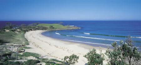
Angourie is a small coastal village in the Clarence Valley Council of New South Wales, Australia. In 2006, Angourie had a population of 170 people (excluding visitors). The median age of the population was 47. Towns that surround Angourie are Yamba and Wooloweyah.
Contents
Map of Angourie NSW 2464, Australia
A local attraction of note is the group of blue and green pools, freshwater pools created when the old quarries hit underground springs. The story goes that the miners working on the quarries went home one night and came back the next morning to find the quarries filled with water. The pools are less than 20 metres from the ocean, and the two bodies of water are separated by mounds of quarried rock and earth.
Notable people
References
Angourie, New South Wales Wikipedia(Text) CC BY-SA