
Intercommunality Moyen Verdon Area 9.83 km² | Canton Saint-André-les-Alpes Population (2009) 74 Local time Saturday 12:18 PM | |
 | ||
Weather 11°C, Wind W at 11 km/h, 43% Humidity | ||
Angles is a French commune in the Alpes-de-Haute-Provence department in the Provence-Alpes-Côte d'Azur region of southeastern France.
Contents
- Map of 04170 Angles France
- Geography
- Toponymy
- History
- Administration
- Demography
- Overview
- Agriculture
- Industry
- Service activities
- Natural and technological risks
- Civil heritage
- Religious heritage
- Gallery of Historical Objects in Angles
- References
Map of 04170 Angles, France
Geography
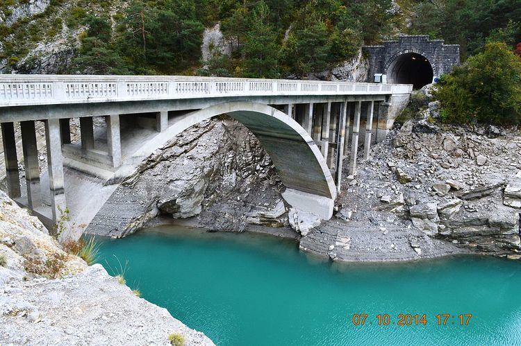
Angles is located some 5 km south-east of Saint-Andre-les-Alpes and 15 km north-east of Castellane. The village is close to the centre of the commune in the valley of the Torrent d'Angles at an altitude of 956m. National Highway N202 passes along the south-west edge of the commune in a tunnel with a country road branching north-east to the village then continuing south-east to Vergons. The commune is remote and rugged with extensive forests totalling 417 hectares which is almost half the total area. There is a small area of farming activity near the village.
The highest points in the commune are at Baisse d'Angles (1577m) and Serre Gros (1778m) on the Crest of Serres.
The Torrent d'Angles flows through the commune from the south-east and curves to the south-west where it joins the Verdon which is at the south-western border of the commune. Many tributaries flow into the Torrent d'Angles from the north including the Ravin des Bastides, Ravin de Pas d'Empicon, and numerous other unnamed streams.
Toponymy
The locality was reported for the first time in texts from the 13th century (Angulis). The name refers to an element of the landscape shaped like a wedge: the village according to Ernest Nègre, or the fields according to Fénié.
The name of the district of Moustier is from the traces of the priory of Lérins in that name.
History
Augustus conquered the valley of the Verdon at the same time as the Alps which he completed in 14 BC. It is difficult to know the name of the Gallic people who inhabited the valley nor who were the Civitas on whom the Angles valley depended in the High Empire: Eturamina (Thorame), Civitas Saliniensum (Castellane), or Sanitensium (Senez). At the end of the Roman Empire, its connection to that of Sanitensium and its diocese seems proven.
The locality appears for the first time in charters from 1245 as it was a co-lordship of the bishops of Senez and the Abbey of Lérins. Its priory was joined to Vergons in 1454. The Abbot of Lérins built a hospice which then passed to Agoult.
The community was under the Viguerie of Castellane.
The inhabitants of Angles lead a struggle against the local lord over several generations and denied the rights of the half-lords to any inheritance. After the non-payments and a trial, the Lord's pew in the church was smashed to pieces. In 1731, the Lord's harvest was not gathered, and everyone was forbidden to do so. The steward narrowly escaped a lynching.
A permanent primary school has existed in Angles since 1776. In 1788 the priory disappeared with the secularization of Lérins Abbey
During the French Revolution the town had a patriotic society which was formed after the end of 1792.
Administration
List of Successive Mayors
(Not all data is known)
Demography
There were 10 fires both in 1315 and in 1471 and a population of 312 in 1765 (Édouard Baratier, Georges Duby & Ernest Hildesheimer).
In 2009 the commune had 74 inhabitants. The evolution of the number of inhabitants is known through the population censuses conducted in the commune since 1793. From the 21st century, a census of communes with fewer than 10,000 inhabitants is held every five years, unlike larger towns that have a sample survey every year.
Sources : Ldh/EHESS/Cassini until 1962, INSEE database from 1968 (population without double counting and municipal population from 2006)
The demographic history of Angles is marked by a period of "stagnation" where the population was relatively stable at a high level. This period lasted until 1861. The rural exodus then caused a decline in population of long duration. By 1901 the town had lost more than half its population from the historical maximum in 1806. The downward trend continued to 1970. Since then population growth has very slowly resumed.
Overview
In 2009 the active population was 27 people, including one unemployed. These workers are mostly employed (19 of 26) and mostly work outside the commune (20 workers of 26). The only employment in the commune is in the tertiary sector.
At 1 January 2011 the primary sector accounted for the largest share of active establishments in town (5 of 11), there are three companies in the secondary sector, and three in the tertiary sector.
Agriculture
At the end of 2010 the primary sector (agriculture, forestry, fisheries) had 5 different establishments.
The number of farms, according to the Agreste survey by the Ministry of Agriculture, remained stable in the 2000s at 3 which specialise in the breeding of sheep. From 1988 to 2000 the agricultural area (UAA) fell significantly to 113 hectares from 603 hectares with most of the remaining in grass. In contrast, the utilized agricultural area declined sharply in the 2000s: it went from 608 to 63 hectares.
Industry
At the end of 2010 the secondary sector (industry and construction) had 3 establishments but had no employees.
Service activities
At the end of 2010, the tertiary sector (trades and services) had 3 establishments (with only one employee).
According to the Departmental Observatory of tourism, the tourism business is important for the town (considering the population) with between 1 and 5 tourists welcomed for each resident. Most of the accommodation capacity is non-market. Structures specifically to accommodate tourists are rare in Angles. There are:
Considering the low supply, it is ultimately the second homes that have the highest capacity: 27 of 64 housing units in the commune are second homes (42%).
Natural and technological risks
None of the 200 communes of the department is in a no seismic risk zone. The canton of Saint-André-les-Alpes to which Angles belongs is in zone 1b (low risk) according to the deterministic classification of 1991, based on the seismic history and in zone 4 (medium risk) according to the probabilistic classification EC8 of 2011. Angles commune is also exposed to four other natural hazards:
The commune of Angles is also exposed to a risk of technological origin: the transport of dangerous goods by road. The N202 national road can be used by trucks carrying dangerous goods and pass within the limits of the commune.
No risk prevention plan for foreseeable natural disasters (PPR) exists for the commune and a DICRIM has existed since 2011.
The town has not been subject to any natural disasters. The earthquake felt most strongly in Angles was at Chasteuil on 30 November 1951.
Civil heritage
The commune has many buildings and structures that are registered as historical monuments:
Religious heritage
The commune has several religious buildings and structures that are registered as historical monuments: