
Population 14,510 (2011) Metropolitan borough City of Liverpool Country England Metropolitan county Merseyside | OS grid reference SJ367933 Region North West Sovereign state United Kingdom Dialling code 0151 | |
 | ||
Anfield is a district of Liverpool, Merseyside, England and a Liverpool City Council Ward. The population of the Liverpool Ward at the time of the 2011 census was 14,510. The district is home to 18-time English champions and five-times European champion football club Liverpool F.C. ever since the club's founding in 1892.
Contents
Map of Anfield, Liverpool, UK
Toponymy
Originally common pasture land within the town of Walton on the Hill, the area had the name of Hanging-fields or Hangfield - the name originating from the deeply sloping (or 'hanging') nature of the terrain. The name was also frequently written as Hongfield or Honghfield. In Gore's paper of 26 July 1810, certain fields are advertised as "Fields in Walton-on-the-Hill, called Hanging-fields"/
Development
In 1836, Walton lost its independence and was made part of Liverpool Borough Council. The Ordnance Survey map of 1840 shows a house here called Anfield House, around which the district developed.
Most of the houses in Anfield are terraced houses from the late 19th and early 20th centuries. This type of property is particularly dense around Anfield stadium, although in 1991 the properties in Kemlyn Road were demolished to make way for a new stand at Anfield stadium.
Walton was an ancient seat of Christianity in Northwest England, and in line with other Victoria era developments, Anfield gained a number of churches, including:
From 1863, the City Council developed the 120 acres (49 ha) Priory Road Cemetery, to which later was added a crematorium.
Present
Anfield is a residential district of Liverpool bordered by a number of areas including Walton, Clubmoor, Tuebrook and Everton.
Demolition of the now defunct Anfield Community Comprehensive School on Priory Road commenced towards the end of 2010 and have been completed in early 2011. Liverpool City Council is currently exploring options for the redevelopment of the site in conjunction with local stakeholders.
Although once a thriving area, Anfield has become increasingly run-down in recent years as its residents have been forced out of their homes on account of the government's controversial Pathfinder scheme.
Landmarks
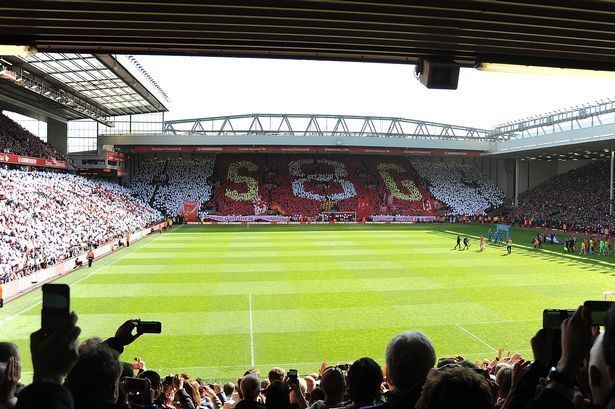
Anfield Stadium, the home of Liverpool F.C., is located within the district. Everton moved to Goodison Park in 1892 and the new Liverpool Football Club moved in.
The area also contains Stanley Park, one of Liverpool's grand Victorian parks, covering 110 acres of Anfield and is the primary separator between Anfield Stadium and Goodison Park in Walton. Liverpool F.C. have speculated for a long time about building a new stadium in Stanley Park.
Notable residents
The Whitney gang also lived in Anfield.
Government
The elected councillors for Anfield are Cllrs Jimmy Kendrick for the Liberal Democrats and two Labour councillors; Brian Dowling and Ian Francis.