
Country United States FIPS code 39-02050 Elevation 333 m Zip code 44003 Local time Thursday 3:05 AM | Time zone Eastern (EST) (UTC-5) GNIS feature ID 1064328 Area 3.55 km² Population 1,127 (2013) Area code 440 | |
 | ||
Weather -3°C, Wind W at 32 km/h, 75% Humidity | ||
Free boondocking bathroom in andover ohio
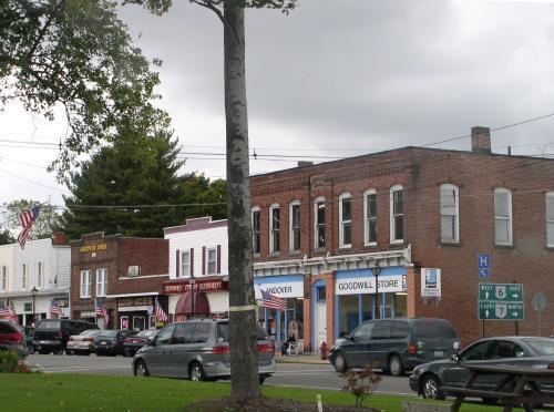
Andover is a village located in the south-east of Ashtabula County, Ohio, United States. The population was 1,145 at the 2010 census.
Contents
- Free boondocking bathroom in andover ohio
- Map of Andover OH 44003 USA
- History
- Geography
- 2010 census
- 2000 census
- Recreation
- Education
- Healthcare
- Notable people
- References
Map of Andover, OH 44003, USA
The closest village to the Ohio side of Pymatuning State Park, the settlement supports a regional tourism industry. Andover was incorporated in 1883.
History
David Lindsey, writing in 1955, observes that "New England Yankees, moving into Ohio's Western Reserve in 1798, brought with them the name Andover from a township in Tolland County, Connecticut, birthplace of many of the migrants. General Henry Champion, second largest shareholder in the Connecticut Land Company, first acquired Andover Township in the drawing for lands held at Hartford in 1798."
A post office with the name Sharon was established August 2, 1815; the name was changed to Andover with effect from March 21, 1826.
Geography
Andover is located at 41°36′28″N 80°34′15″W (41.607744, -80.570729)., only 2.7 miles west of the border to Pennsylvania.
According to the United States Census Bureau, the village has a total area of 1.37 square miles (3.55 km2), all land.
2010 census
As of the census of 2010, there were 1,145 people, 411 households, and 264 families residing in the village. The population density was 835.8 inhabitants per square mile (322.7/km2). There were 469 housing units at an average density of 342.3 per square mile (132.2/km2). The racial makeup of the village was 95.5% White, 2.8% African American, 0.3% Native American, 0.1% Asian, and 1.4% from two or more races. Hispanic or Latino of any race were 1.7% of the population.
There were 411 households of which 31.9% had children under the age of 18 living with them, 46.0% were married couples living together, 13.4% had a female householder with no husband present, 4.9% had a male householder with no wife present, and 35.8% were non-families. 30.7% of all households were made up of individuals and 17% had someone living alone who was 65 years of age or older. The average household size was 2.44 and the average family size was 3.04.
The median age in the village was 44.2 years. 22.9% of residents were under the age of 18; 7.2% were between the ages of 18 and 24; 20.8% were from 25 to 44; 27.7% were from 45 to 64; and 21.4% were 65 years of age or older. The gender makeup of the village was 45.4% male and 54.6% female.
2000 census
As of the census of 2000, there were 1,269 people, 427 households, and 271 families residing in the village. The population density was 929.2 people per square mile (357.6/km²). There were 463 housing units at an average density of 339.0 per square mile (130.5/km²). The racial makeup of the village was 95.82% White, 3.07% African American, 0.32% from other races, and 0.79% from two or more races. Hispanic or Latino of any race were 1.18% of the population. 23.6% were of American, 14.9% German, 13.8% Irish, 9.4% English and 7.0% Italian ancestry according to Census 2000.
There were 427 households out of which 34.4% had children under the age of 18 living with them, 51.1% were married couples living together, 9.4% had a female householder with no husband present, and 36.3% were non-families. 33.5% of all households were made up of individuals and 21.1% had someone living alone who was 65 years of age or older. The average household size was 2.53 and the average family size was 3.27.
In the village, the population was spread out with 25.0% under the age of 18, 5.6% from 18 to 24, 25.2% from 25 to 44, 22.5% from 45 to 64, and 21.7% who were 65 years of age or older. The median age was 40 years. For every 100 females there were 88.3 males. For every 100 females age 18 and over, there were 82.0 males.
The median income for a household in the village was $31,250, and the median income for a family was $45,526. Males had a median income of $31,845 versus $22,679 for females. The per capita income for the village was $14,702. About 8.2% of families and 10.7% of the population were below the poverty line, including 11.3% of those under age 18 and 20.7% of those age 65 or over.
Recreation
Pymatuning Lake is a man-made lake in Andover bordering Pennsylvania within Pymatuning State Park. Every summer about 30,000 vacationers visit Pymatuning Lake for boating, fishing, swimming, and camping.
John R. Overly Recreation Park is located on Chestnut Street in Andover with a playground, hiking/biking paths, and a picnic area with a pavilion. The park also has a ball field and volleyball court. Open houses are celebrated here often.
Andover is home to the Pymatuning Lake Drive-In, one of the few remaining drive-in theaters in the United States. The Pymatuning Lake Drive-In is located approximately two miles south of the village. During the summer months the drive-in is home to the Andover Flea Market, which is frequented on weekends by many tourists. The drive in is no longer operating.
Education
The Pymatuning Valley School District operates elementary and high schools in Andover. The district just recently completed major renovations as the high school, middle school, and elementary school are now all located on the same campus just west of town.