
Country Philippines Time zone PST (UTC+8) Dialing code +63 (0)64 Elevation 21 m Province Maguindanao | Barangays ZIP code 9609 Area 255.4 km² Local time Wednesday 12:41 PM | |
 | ||
Region Autonomous Region in Muslim Mindanao (ARMM) Weather 31°C, Wind NE at 10 km/h, 61% Humidity | ||
Ampatuan is a 4th class municipality in the province of Maguindanao, Philippines. According to the 2015 census, it has a population of 24,801 people.
Contents
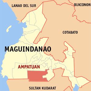
Map of Ampatuan, Maguindanao, Philippines
Barangays
Ampatuan is politically subdivided into 11 barangays.
History
Ampatuan was created out of 23 barrios of Datu Piang on 21 June 1959 by Republic Act No. 2509. On 22 November 1973, the municipality of Esperanza was carved out of its territory and was made part of the province of Sultan Kudarat, while Ampatuan itself was made part of Maguindanao, when the old Cotabato province was divided into three provinces on the same date. It further lost territory, when its electorate ratified on 3 January 2004, the separation of ten of its barangays to form the municipality of Datu Abdullah Sangki.
The town was the site of the Maguindanao Massacre on 23 November 2009. The victims were about to file a certificate of candidacy for Esmael Mangudadatu, vice mayor of Buluan town for the province's gubernatorial election. Mangudadatu was challenging Andal Ampatuan Jr. (son of the incumbent Maguindanao governor Datu Andal Ampatuan Sr., the mayor of Datu Unsay, and accused of leading the massacre) in the election. Currently, the elected Municipal Officials are headed by Datu Rasul M. Sangki-Mayor and Datu Samnon M. Sangki-Vice Mayor.