
Country United States Elevation 1,437 m Population 14,460 (2013) | Incorporated 1905 Area code(s) 208 Zip code 83406 Local time Tuesday 3:02 PM | |
 | ||
Weather -2°C, Wind SW at 34 km/h, 74% Humidity | ||
Ammon is a city in Bonneville County, Idaho, United States. As of the 2010 US Census, the population of Ammon was 13,816.
Contents
- Map of Ammon ID USA
- Amenities and attractions
- History
- Education
- High schools
- Alternative high schools
- Middle schools
- Elementary schools
- Geography
- 2010 census
- 2000 census
- References
Map of Ammon, ID, USA
Ammon is located in the Upper Snake River Valley. Its western boundary abuts the City of Idaho Falls, Idaho. Foothills and mountains outline Ammon’s eastern and southern skies. The Caribou National Forest with its Blackfoot Mountain range begins ten miles to the south, and its rugged Caribou Mountain Range lies 20 miles to the east.
Ammon is one of Idaho’s fastest growing cities. The City of Ammon’s growth rate from 2000 to 2010 was 123.3% based on the 2010 US Census and is the State of Idaho’s 17th largest City.
The City’s rapid growth is due to its availability of open space for affordable residential housing and the City’s hometown lifestyle, as well as its near proximity to the urban amenities and job market in Idaho Falls.
Amenities and attractions
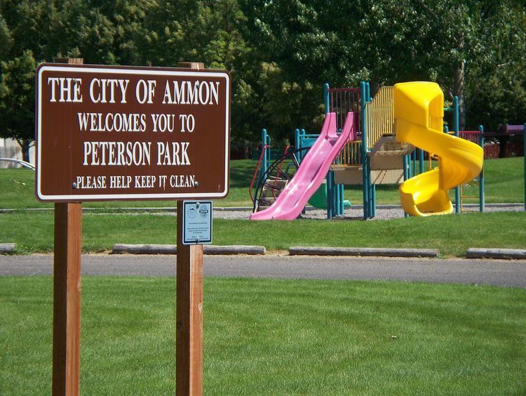
The City of Ammon has nine parks totaling over 62 acres. The 18 acre McCowin Park is the City’s largest park. It has a swimming pool, picnic shelter, playground equipment, and tennis courts, horseshoe pits, walking path, and ball fields. The amenities of the other parks include shelters, playground equipment, Tot Park, facilities for athletics, and picnics.
Within an hour’s drive from the City, opportunities abound for boating, rafting, canoeing, hunting, fishing, camping, snow and water skiing, snowmobiling, and ice fishing. Entrances to Yellowstone and Grand Teton National Parks, as well as the Jackson Hole Valley, home of the City of Jackson, Wyoming and the National Elk Refuge are all just less than a 2-hour drive away.
History
Ammon was founded by members of The Church of Jesus Christ of Latter-day Saints in 1888. It was originally called South Iona because it was the dependent branch in the south end of the Iona, Idaho ward. The area was made a ward in the church in 1889 with Arthur M. Rawson as bishop, who renamed the town in honor of Ammon, a figure in the LDS book of scripture, the Book of Mormon. Since it was now independent of the Iona Ward, a new name seemed appropriate. On February 9, 1893, the name of the town was changed from South Iona Ward to Ammon.
By 1930 the village of Ammon had 270 inhabitants, but the total district of Ammon, which is how the name is usually used and is closer to the modern borders, had a population of about 1100.
Ammon was an early agricultural center and later was home to several general stores, a grain elevator and a brickyard. The city was officially incorporated on October 10, 1905. It became a Second Class City under Idaho law in 1963. In the early 1900s a spur line was built by the Eastern Idaho Railroad to the Ammon Elevator. Beginning in the 1940s housing divisions have aided the city's growth and it has become a suburb for the adjacent city of Idaho Falls. Building boomed in the 1990s in both the business and housing sectors, and the city was one of the fastest growing in Idaho from 2000 to 2010.
Education
Ammon is served by the Bonneville Joint School District #93.
High schools
Alternative high schools
Middle schools
Elementary schools
Geography
Ammon is located at 43°28′35″N 111°58′5″W (43.476268, -111.967964).
According to the United States Census Bureau, the city has a total area of 7.27 square miles (18.83 km2), of which, 7.26 square miles (18.80 km2) is land and 0.01 square miles (0.03 km2) is water.
2010 census
As of the census of 2010, there were 13,816 people, 4,476 households, and 3,352 families residing in the city. The population density was 1,903.0 inhabitants per square mile (734.8/km2). There were 4,747 housing units at an average density of 653.9 per square mile (252.5/km2). The racial makeup of the city was 94.1% White, 0.5% African American, 0.5% Native American, 0.8% Asian, 0.1% Pacific Islander, 2.2% from other races, and 1.8% from two or more races. Hispanic or Latino of any race were 6.4% of the population.
There were 4,476 households of which 46.4% had children under the age of 18 living with them, 61.4% were married couples living together, 10.1% had a female householder with no husband present, 3.4% had a male householder with no wife present, and 25.1% were non-families. 21.3% of all households were made up of individuals and 8.2% had someone living alone who was 65 years of age or older. The average household size was 3.05 and the average family size was 3.61.
The median age in the city was 29.6 years. 36.3% of residents were under the age of 18; 7.7% were between the ages of 18 and 24; 27.5% were from 25 to 44; 18.7% were from 45 to 64; and 9.8% were 65 years of age or older. The gender makeup of the city was 48.9% male and 51.1% female.
2000 census
As of the 2000 Census there were 1,843 households out of which 49.9% had children under the age of 18 living with them, 72.0% were married couples living together, 9.4% had a female householder with no husband present, and 16.1% were non-families. 13.8% of all households were made up of individuals and 6.3% had someone living alone who was 65 years of age or older. The average household size was 3.27 and the average family size was 3.62.
In 2000 the city the population was spread out with 36.3% under the age of 18, 8.9% from 18 to 24, 26.8% from 25 to 44, 18.4% from 45 to 64, and 9.6% who were 65 years of age or older. The median age was 29 years. For every 100 females there were 97.0 males. For every 100 females age 18 and over, there were 89.6 males.
The median income for a household in the city in 2000 was $47,820, and the median income for a family was $51,544. Males had a median income of $41,126 versus $21,301 for females. The per capita income for the city was $16,535. About 3.4% of families and 5.6% of the population were below the poverty line, including 5.0% of those under age 18 and 9.6% of those age 65 or over.