
 | ||
Island groups Aleutian Islands, Andreanof Islands | ||
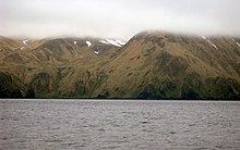
Amatignak Island (Aleut: Amatignax̂) is a member of the Delarof Islands (western Andreanof Islands), in Alaska's Aleutian archipelago. The southernmost point of Alaska is on this island, as well as the westernmost longitude of Alaska, the United States, and North America.
Map of Amatignak Island, Alaska, USA
The island is about 5 mi (8 km) long north-to-south, and about 3 mi (4 km) wide east-to-west. It is uninhabited. The nearest island is Ulak Island about 4 mi (6 km) to the northeast.
References
Amatignak Island Wikipedia(Text) CC BY-SA