
Region Papaloapan Town status 1816 Population 22,330 (2005) Area code 297 | Area 840 km² Local time Monday 4:26 AM | |
 | ||
Founded 1518 (as San Cristóbal de Alvarado) Weather 22°C, Wind S at 6 km/h, 90% Humidity | ||
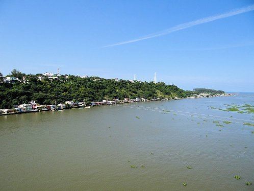
Alvarado (officially: Ilustre, Heroica y Generosa Ciudad y Puerto de Alvarado) is a city in the Mexican state of Veracruz. The city also serves as the municipal seat for the surrounding municipality of the same name. It is located 64 km (40 mi) from the city of Veracruz, Veracruz, on Federal Highways 180 and 125. Alvarado is bordered by Boca del Río, Tlalixcoyan, Medellín, Ignacio de la Llave, Ciudad Lerdo de Tejada, Tlacotalpan and Acula. It is 10 m (33 ft) above sea level. It lies in the so-called "Region Papaloapan" bordered on the south by the municipalities of Acula, Tlacotalpan and Lerdo de Tejada, on the east by the Gulf of Mexico and on the west by Ignacio de la Llave.
Map of Alvarado, Ver., Mexico
The geographic size of Alvarado is 840 square kilometres (320 sq mi).
The INEGI said that the population by 2000 was 22,608 people.
Alvarado was founded in the 16th century. In 1518, Pedro de Alvarado arrived to Atlizintla and name the town and river after himself. Then in 1563, Juan de Sahagún built the port of Alvarado. It was used to transport food to other countries.
Major products of Alvarado are coffee, fruits, and sugar. The economy of this region is based on fishing and farming. Sugar cane and coffee are common products of this region.