
Country United States County Santa Clara FIPS code 06-01458 Area 3.118 km² Zip code 95127 Area code Area codes 408 and 669 | State California Time zone Pacific (UTC-8) GNIS feature IDs 218196, 2407736 Elevation 46 m Population 15,536 (1 Apr 2010) | |
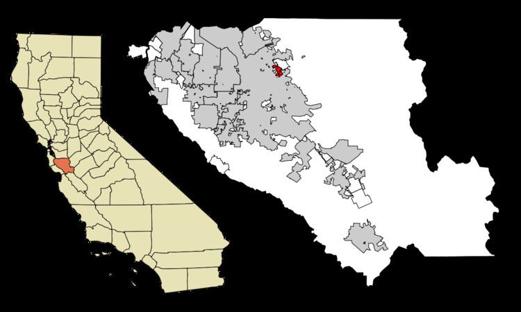 | ||
Alum Rock (/ˈæləm/) is a census-designated place (CDP) in Santa Clara County, California, United States and a community of San Jose. The CDP, which excludes all annexed areas, had a population of 15,536 at the 2010 census. Alum Rock was named after a rock formerly thought to be composed of alum in nearby Alum Rock Park. Formerly a separate town, much of the community is unincorporated surrounded by incorporated San Jose; neighborhoods between White Road and Capitol Avenue are part of a city/county agreement for annexation. James Lick High School, Mt. Pleasant High School, and William C. Overfelt High School (which are part of the East Side Union High School District), Joseph George Middle School, Ocala Middle School, and other schools in the Alum Rock Union School District serve the neighborhood. Near the center of the community is a small neighborhood commercial strip along Alum Rock Avenue at White Road.
Contents
Map of Alum Rock, CA, USA
History
In the 19th century and early 20th century Alum Rock was mostly fruit orchard land. During the 1940s and 1950s, developers began building residential housing and formed the community of Alum Rock. During that time, Alum Rock Avenue and a passenger railroad passed through the town on the way to Alum Rock Park. In the 1980s and 1990s, Alum Rock's neighborhood became increasing older and more populated with Latino immigrants as "white flight" affected the area. Today, Alum Rock remains a unique community separated from the rest of San Jose.
The magnitude 5.6 Alum Rock earthquake occurred just northeast of the community on October 30, 2007, the strongest to hit the region since the 1989 Loma Prieta earthquake. No significant damage or injuries were reported.
Geography
Alum Rock is located at 37°22′3″N 121°49′32″W (37.367590, -121.825473).
According to the United States Census Bureau, the CDP has a total area of 1.2 square miles (3.1 km2), all of it land.
Demographics
These figures do not include any part of Alum Rock which has been incorporated into San Jose at the time of the census.
2010
The 2010 United States Census reported that Alum Rock had a population of 15,536. The population density was 12,899.0 people per square mile (4,980.3/km²). The racial makeup of Alum Rock was 6,581 (42.4%) White, 207 (1.3%) African American, 298 (1.9%) Native American, 2,039 (13.1%) Asian, 70 (0.5%) Pacific Islander, 5,466 (35.2%) from other races, and 875 (5.6%) from two or more races. Hispanic or Latino of any race were 10,977 persons (70.7%).
The Census reported that 15,364 people (98.9% of the population) lived in households, 66 (0.4%) lived in non-institutionalized group quarters, and 106 (0.7%) were institutionalized.
There were 3,686 households, out of which 1,895 (51.4%) had children under the age of 18 living in them, 2,064 (56.0%) were opposite-sex married couples living together, 621 (16.8%) had a female householder with no husband present, 335 (9.1%) had a male householder with no wife present. There were 241 (6.5%) unmarried opposite-sex partnerships, and 23 (0.6%) same-sex married couples or partnerships. 444 households (12.0%) were made up of individuals and 181 (4.9%) had someone living alone who was 65 years of age or older. The average household size was 4.17. There were 3,020 families (81.9% of all households); the average family size was 4.33.
The population was spread out with 4,383 people (28.2%) under the age of 18, 1,709 people (11.0%) aged 18 to 24, 4,708 people (30.3%) aged 25 to 44, 3,345 people (21.5%) aged 45 to 64, and 1,391 people (9.0%) who were 65 years of age or older. The median age was 31.7 years. For every 100 females there were 105.9 males. For every 100 females age 18 and over, there were 104.2 males.
There were 3,863 housing units at an average density of 3,207.3 per square mile (1,238.4/km²), of which 2,393 (64.9%) were owner-occupied, and 1,293 (35.1%) were occupied by renters. The homeowner vacancy rate was 1.8%; the rental vacancy rate was 3.2%. 9,541 people (61.4% of the population) lived in owner-occupied housing units and 5,823 people (37.5%) lived in rental housing units.
2000
As of the census of 2000, there were 13,479 people, 3,345 households, and 2,736 families residing in the CDP. The population density was 12,044.7 people per square mile (4,646.7/km²). There were 3,411 housing units at an average density of 3,048.0/sq mi (1,175.9/km²). The racial makeup of the CDP was 44.14% White, 2.23% African American, 1.71% Native American, 8.70% Asian, 0.39% Pacific Islander, 36.89% from other races, and 5.94% from two or more races. Hispanic or Latino of any race were 66.99% of the population.
There were 3,345 households out of which 44.5% had children under the age of 18 living with them, 57.4% were married couples living together, 16.2% had a female householder with no husband present, and 18.2% were non-families. 13.0% of all households were made up of individuals and 6.2% had someone living alone who was 65 years of age or older. The average household size was 3.98 and the average family size was 4.17.
In the CDP, the population was spread out with 30.6% under the age of 18, 10.7% from 18 to 24, 32.5% from 25 to 44, 17.2% from 45 to 64, and 9.1% who were 65 years of age or older. The median age was 30 years. For every 100 females there were 105.0 males. For every 100 females age 18 and over, there were 103.0 males.
The median income for a household in the CDP was $54,567, and the median income for a family was $53,872. Males had a median income of $31,485 versus $28,154 for females. The per capita income for the CDP was $15,359. About 8.2% of families and 10.9% of the population were below the poverty line, including 9.6% of those under age 18 and 11.8% of those age 65 or over.
Government
In the California State Legislature, Alum Rock is in the 15th Senate District, represented by Democrat Jim Beall, and in the 27th Assembly District, represented by Democrat Ash Kalra.
In the United States House of Representatives, Alum Rock is in California's 19th congressional district, represented by Democrat Zoe Lofgren.
In the San Jose City Council, it falls under District 5, represented by Council Member Magdalena Carrasco