
Country United States FIPS code 04-01920 Elevation 2,442 m Population 145 (2010) | Time zone MST (UTC-7) GNIS Feature ID 25603 Area 160 ha Local time Sunday 4:22 PM | |
 | ||
Weather 4°C, Wind SW at 19 km/h, 36% Humidity | ||
Alpine is an unincorporated community and census-designated place in Apache County, Arizona, United States, in Bush Valley in the east central part of the state. As of the 2010 census, it had a population of 145.
Contents
- Map of Alpine AZ 85920 USA
- History
- Geography
- Climate
- Government and infrastructure
- Attractions
- Education
- References
Map of Alpine, AZ 85920, USA
History
Alpine was settled in 1876 by Anderson Bush, who built a log house originally known as "Fort Bush". Bush sold his holdings in 1879 to William Maxwell and Fred Hamblin, Mormon settlers who established the town as a Mormon community.
Geography
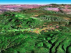
Alpine is located at an elevation of 8,050 feet (2,450 m) above sea level in the eastern end of the White Mountains and surrounded by the Apache-Sitgreaves National Forest. Alpine is a popular destination for hunting, fishing, and camping. Alpine is near the headwaters of the San Francisco River and six miles from the New Mexico border. As of 1960, it was the highest place in the United States where farming was successfully occurring.
The Alpine post office has the ZIP code of 85920.
Climate
Alpine has a warm-summer Mediterranean climate (Köppen Csb) influence by its very high altitude and the North American Monsoon, which brings frequent thunder showers during the summer. Although temperatures are generally comfortable during the daytime, the sun is very intense and at night frosts have occurred even in summer and are an almost daily occurrence from October to May.
Winters are cold, with storms bringing precipitation mostly in the form of snow. Because Alpine is on the eastern end of the Mogollon Rim, it experiences a rain shadow from the White Mountains: it gets less snowfall than points west at a similar elevation.
Government and infrastructure
The U.S. Postal Service operates the Alpine Post Office on U.S. Route 191.
Attractions
Education
The Alpine Elementary School District, operating Alpine Elementary School, serves Alpine.
The Apache County Library District operates the Alpine Public Library.