
PIN 415 603 Elevation 73 m Population 5,315 (2006) | Time zone IST (UTC+5:30) Telephone code 02355 Local time Monday 1:02 AM Area code 02355 | |
 | ||
Weather 26°C, Wind S at 2 km/h, 46% Humidity | ||
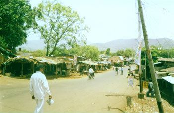
Alore is a village in the Chiplun subdivision of Ratnagiri district, Maharashtra, India. It lies on a bypass of the state highway linking Chiplun to Karad.
Map of Alore, Maharashtra 415603
Alore has many facilities such as a hospital, reputed school, engineering college, market area, net cafe, continuous electricity, eat outs. This is happened because of the Irrigation department offices present in the town. Koyna Dam Maintenance Division (KDMD) has its main base in Alore.
A government guesthouse is the only lodging in this village. It is located 12 kilometres east of Chiplun, the nearest town. Marathi is the most common language spoken here.
References
Alore Wikipedia(Text) CC BY-SA