
Native name Альма Length 83 km Source Crimean Mountains | Country Crimea Basin area 635 km² Mouth Black Sea | |
 | ||
Main source Babuğan Yayla, Crimean Mountains River mouth Kalamita bay of the Black Sea | ||
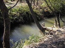
The Alma (Ukrainian: Альма; Russian: Альма, Crimean Tatar: Alma) is a small river in Crimea that flows into the Black Sea. Its mouth is located half-way between Yevpatoria and Sevastopol. Alma is the Crimean Tatar word for an "apple".
Map of Al'ma river
The Alma is formed by the confluence of the Sary-su, the Savlykh-su and the Babuganka (Babuğan Yayla) rivers, and flows mostly through the mountains. The Alminskoye and Partizanskoye storage reservoirs are located along its course.
Near the Alma river the allied British, French, and Ottoman armies defeated the Russians under Prince Aleksandr Sergeevich Menshikov 20 September 1854, see Battle of Alma.
References
Alma River (Crimea) Wikipedia(Text) CC BY-SA