
Last eruption Unknown Mountain range Pacific Coast Ranges | Elevation 2,217 m | |
 | ||
Similar Cocoa Crater, Nahta Cone, Kostal Cone, Kitasu Hill, Bridge River Cones | ||
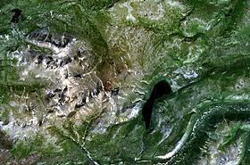
The Alligator Lake volcanic complex is a group of basaltic cinder cones and lava flows in south central Yukon. The upper part of the Alligator Lake volcanic complex consists of two well-preserved cinder cones capping a small shield volcano. They probably post-date the local Holocene glaciation. Lava flows from both cinder cones traveled to the north and were erupted simultaneously. Their compositions range from alkali olivine basalt to basanitic. Lava flows from the northeast cone are the largest extending 6 km (4 mi) from the cone and expanding to a width of 10 km (6 mi) at the terminus.
Map of Alligator Lake volcanic complex, Whitehorse, Yukon, Canada
The volcanic complex was named by the nearby Alligator Lake.
References
Alligator Lake volcanic complex Wikipedia(Text) CC BY-SA