
 | ||
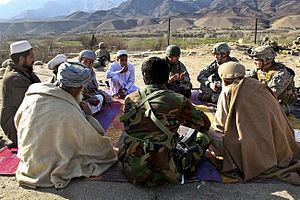
Alingar District is located approximately 27 km from Mehtarlam, the provincial capital of Laghman Province and borders with Alishing and Dawlat Shah districts to the West, Nuristan Province to the North, Kunar and Nangarhar provinces to the East and Qarghayi and Mihtarlam districts to the South.It has about 60 villages located in four main valleys. The population is 85,600 (2006) - 70% of them Pashtun, 20% Pashai and 5% Tajik. The district center is the village of 'Shahi, located on 34.8347°N 70.3603°E / 34.8347; 70.3603 at 915 m altitude. in the valley of the Alingar River, which crosses the district and is the main source of irrigation. The security situation is reported to be relatively stable, although there are some private disputes. The district is reported free of mines.
Map of Alingar, Afghanistan
The main crops are wheat, rice, corn, vegetables. There are also fields with poppy. The district is mountainous, hence there is little arable land. Some of the agricultural land has been destroyed by flooding. The main sources of income are farming, daily wage labour and remittances from abroad. It was reported that around 30% of the population work in agriculture, 20% work abroad in Pakistan and Iran, 2% are government employees, 2% traders, and around 45% are without work.
During the wars 80% of the houses were destroyed and many fled to Pakistan and now they are returning slowly. The health care and education sectors are relatively well, but improvement is needed especially in the distant villages.