
- elevation 405 m (1,329 ft) - elevation 225 m (738 ft) Source Great Dividing Range | - location north-east of Isisford Length 303 km Mouth Barcoo River | |
 | ||
- location east of Aramac, Central Queensland | ||
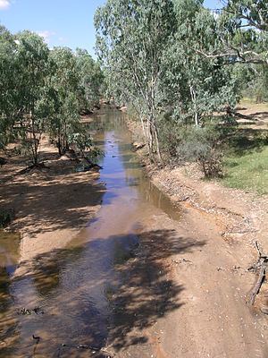
The Alice River in central Queensland, Australia rises on the western slopes of the Great Dividing Range. The river bisects the Shire of Barcaldine, flowing in a south-westerly direction towards Isisford and its confluence with the Barcoo River to form Cooper Creek. Barcaldine is located on Lagoon Creek, which flows into the Alice River approximately five kilometre s to the south. The Alice River is often dry, except after the annual summer rains.
The Barcoo River forms the boundary of outback Australia with little in the way of civilization west of the Barcoo. Waters from the Barcoo and Alice Rivers flow towards Lake Eyre in Central Australia, while rivers further east join the Murray-Darling basin and reach the sea in South Australia.
HistoryEdit
In 1846, Thomas Mitchell became the first European to see the Barcoo and Alice Rivers. The Alice River was named by Mitchell and Mitchell's name was adopted for the pastoral district and for its grass, Mitchell grass. In October 1863, Donald Cameron, his son John, together with James and William Crombie walked sheep from the New England district of New South Wales and grazed them along a 40-mile frontage of the Alice River. They named their property Barcaldine after a family farm in Scotland.
In 1891 the Alice River had a record flood that stopped traffic for a week. On 20 March 1910 the Alice River flooded all the low-lying country and the railway line was blocked.