I love writing and learning new things in order to better educate those in need. I also enjoy hackathons and adventures around the world.
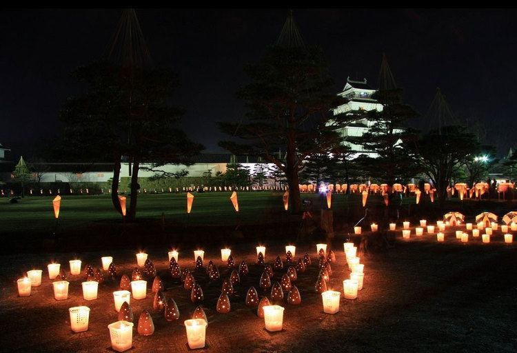
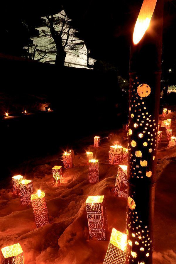
Aizuwakamatsu, Fukushima
Updated on
Edit
Like
Comment
Share
Sign in
Country
Japan
Area
383.03 km2
Mayor
Ichiro Kanke
University
University of Aizu
Region
Tohoku
Population
126,220 (2010)
Map of Aizuwakamatsu, Fukushima
Aizuwakamatsu(会津若松市,Aizuwakamatsu-shi) is a city in Fukushima Prefecture, in northern Honshu, Japan. As of September 2014, the city had an estimated population of 122,715 and a population density of 321 persons per km². The total area was 383.03 km².
The area of present-day Aizuwakamatsu was part of ancient Mutsu Province, and was settled from prehistoric times. The Aizu-Otsuka Kofun within the city borders dates from the 4th century AD, and is an Important Cultural Property of Japan. During the Sengoku period and in the Edo period, the area developed as a castle town to Aizu Domain formed part of the holdings of Aizu Domain during the Edo period and was the location of the Battle of Aizu, one of the largest conflicts of the Boshin War. After the Meiji Restoration, Wakamatsu Town was created with the establishment of the municipalities system on April 1, 1889. It became Wakamatsu City in 1899. The name was changed to Aizuwakamatsu in 1955.
Geography
Aizuwakamatsu is located in the western part of Fukushima Prefecture, in the southeast part of Aizu basin. The main transport hub is Aizu Wakamatsu Station.
Mountains
Mount Ōtodake (1416 m)
Mount Seaburi
Mount Oda
Mount Iimori
Rivers
Aga River
Nippashi River
Yugawa River
Sesenagi River
Lakes
Lake Inawashiro
Lake Wakasato
Lake Higashiyama
Lake Sohara
Hot springs
Higashiyama Onsen
Ashinomaki Onsen
Administrative divisions
There are 11 administrative divisions (hamlets or 大字 (ooaza)) in the city.
Wakamatsu
Machikita
Kouya
Kouzashi
Monden
Ikki
Higashiyama
Ōto
Minato
Kitaaizu
Kawahigashi
Neighboring municipalities
North: Kitakata, Aizubange, Yugawa, Bandai
East: Koriyama, Inawashiro
West: Aizumisato
South: Shimogo, Tenei
Climate
Although it is located in an inland valley, Aizuwakamatsu's climate resembles that of the Hokuriku region on the Sea of Japan coast. Snowfall is very heavy during the winter at 4.78 metres (190 in), and snow cover reaches an average maximum of 0.39 metres (15.35 in) and has reached as much as 1.15 metres (45.3 in) for short periods, a figure one would usually associate with much colder regions like the Labrador Peninsula.
Mergers
On April 1, 1937, a part of Machikita village (from Kitaaizu District) was merged into the city of Wakamatsu.
On April 1, 1951, the village of Machikita (remaining parts) (from Kitaaizu District) was later merged into Wakamatsu.
On January 1, 1955, 7 villages of Kitaaizu District (Kouya, Kouzashi, Monden, Ikki, Higashiyama, Ōto and Minato) were merged into Wakamatsu. And the city's name changed to "Aizuwakamatsu".
On April 1, 1955, a part of the town of Hongō (locality of Oya) (from Ōnuma District) was merged into Aizuwakamatsu.
On November 1, 2004, the village of Kitaaizu (from Kitaaizu District) was merged into Aizuwakamatsu. Therefore, Kitaaizu District was dissolved as a result of this merger.
On November 1, 2005, the town of Kawahigashi (from Kawanuma District) was merged into Aizuwakamatsu.