
Country United States GNIS feature ID 1660231 Local time Thursday 12:56 AM | Time zone Pacific (PST) (UTC-8) Elevation 428 m Area code 805 | |
 | ||
Weather 4°C, Wind SW at 0 km/h, 90% Humidity | ||
Adelaida is an unincorporated community in San Luis Obispo County, California, United States. Adelaida is 10 miles (16 km) west of Paso Robles. The community had a post office from 1877 to 1936.
Contents
Map of Adelaida, CA 93446, USA
Adelaida is locally pronounced without the terminal "a." 19th century documents commonly spell the place name as "Adelaide".
History
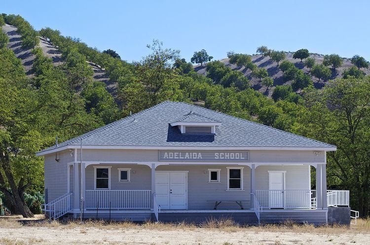
In the 1880s, the population of Adelaida was approximately 500, supported by the prospering Klau and Buena Vista mercury mines. The town boasted a community center, saloon, dance hall, general store, and four schools. The population increased further in 1898 with an influx of Mennonite settlers. The Adelaida School, located near the entrance to the Osgood Ranch on Chimney Rock Road, was built in 1917. It is being restored by the Adelaida Historical Foundation. This school and the Klau Mine Road cemetery are all that is left of old Adelaida. Although the quicksilver mines were in operation into the 1970s, most of the local businesses had long since relocated to Paso Robles.