
Country United States FIPS code 23-00380 Elevation 24 m Population 1,266 (2010) Area code 207 | Time zone Eastern (EST) (UTC-5) GNIS feature ID 0582316 Zip code 04606 Local time Thursday 3:14 AM | |
 | ||
Weather 7°C, Wind SW at 11 km/h, 100% Humidity Area 260.2 km² (109.9 km² Land / 150.3 km² Water) | ||
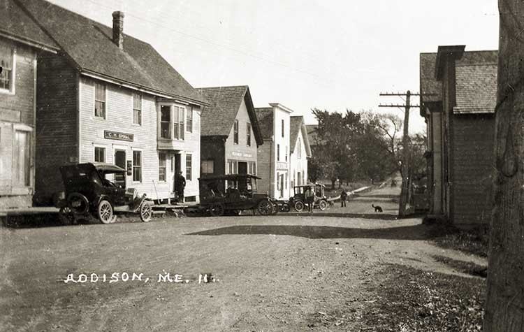
Addison is a town in Washington County, Maine, United States. The town was named after English author Joseph Addison. The population was 1,266 as of the 2010 census.
Contents
- Map of Addison ME USA
- Early settlement
- Key dates in history
- Geography
- 2010 census
- 2000 census
- Population
- Economy
- Housing
- Recreation
- Transportation
- Public facilities and services
- Fiscal capacity
- Land use
- Mayhew Library
- Quarries
- Schools
- Shipyards
- Historic buildings
- Cemeteries
- Notable people
- References
Map of Addison, ME, USA
Early settlement
The earliest white settlers in Addison were from Martha's Vineyard. They were looking for richer farmlands, cod, and good meadow grass for their cattle. Some of the earliest permanent settlers of whom we have any knowledge were William Hix, Wilmont Wass, Moses Plummer, Seth Norton, Richard Samuel Coffin, Daniel Look and John Nash,Tilly White of Lancaster, Massachusetts, with most arriving in 1767. Addison was settled about 1779 and was organized as a plantation, known as "Number Six West of Machias". It was then called Pleasant River and also "Englishman's River". It was incorporated as a town on February 14, 1797, and named in honor of the English writer, Joseph Addison. The Bangor Historical Magazine gives the entire number of inhabitants as 213 on April 27, 1778. It has been said that "practically all the residents of Addison are descendants in one way or another of the Vineyard Settlers."
The town itself spreads over a large area and includes many islands, coves and headlands. In the late 19th century and into the 20th century there were manufacturing plants including clam, sardine, blueberry and lobster canneries. None of these are in existence at the present time. Today Addison is mainly a fishing port with lobsters, scallops, clams, periwinkles and mussels as the principal catches.
Key dates in history
marsh hay, and other small farming and forestry occupations
River, and South Addison
Chapman" to join a religious community
Addison
Geography
According to the United States Census Bureau, the town has a total area of 100.47 square miles (260.22 km2), of which, 42.44 square miles (109.92 km2) of it is land and 58.03 square miles (150.30 km2) is water.
2010 census
As of the census of 2010, there were 1,266 people, 529 households, and 359 families residing in the town. The population density was 29.8 inhabitants per square mile (11.5/km2). There were 809 housing units at an average density of 19.1 per square mile (7.4/km2). The racial makeup of the town was 96.4% White, 0.5% African American, 1.7% Native American, 0.6% Asian, 0.1% from other races, and 0.7% from two or more races. Hispanic or Latino of any race were 0.7% of the population.
There were 529 households of which 28.5% had children under the age of 18 living with them, 56.0% were married couples living together, 7.2% had a female householder with no husband present, 4.7% had a male householder with no wife present, and 32.1% were non-families. 22.7% of all households were made up of individuals and 9.6% had someone living alone who was 65 years of age or older. The average household size was 2.37 and the average family size was 2.77.
The median age in the town was 45.1 years. 20.5% of residents were under the age of 18; 5.5% were between the ages of 18 and 24; 23.8% were from 25 to 44; 30.9% were from 45 to 64; and 19.3% were 65 years of age or older. The gender makeup of the town was 49.4% male and 50.6% female.
2000 census
As of the census of 2000, there were 1,209 people, 489 households, and 341 families with a population density of 28.5 people per square mile (11.0/km²), and 723 housing units at an average density of 17.1 per square mile (6.6/km²). The racial makeup of the town was 98.10% White, 0.58% African American, 0.25% Native American, 0.25% Asian, 0.08% Pacific Islander, 0.08% from other races, and 0.66% from two or more races. Hispanic or Latino of any race were 0.17% of the population.
There were 489 households out of which 31.1% of which had children under the age of 18 living in them, 59.5% were married couples living together, 6.1% had a female householder with no husband present, and 30.1% were non-families. 21.1% of all households were made up of individuals and 9.2% had someone living alone who was 65 years of age or older. The average household size was 2.45 and the average family size was 2.83.
In the town, the population was spread with 23.5% under the age of 18, 6.1% from 18 to 24, 26.8% from 25 to 44, 29.5% from 45 to 64, and 14.1% were 65 years of age or older. The median age was 40 years. For every 100 females there were 96.9 males. For every 100 females age 18 and over, there were 96.4 males.
The median income for a household in the town was $26,083, and the median income for a family was $30,000. Males had a median income of $22,432 versus $18,194 for females. The per capita income for the town was $15,951. About 14.7% of families and 20.4% of the population were below the poverty line, including 27.9% of those under age 18 and 16.6% of those age 65 or over.
Population
The population of Addison has experienced slight long-term growth, but with an aging population. The number of school age children has declined, shown by decreasing local school enrollments. As with the whole of Washington County, the town has seen a decrease in the average household size. In addition, more retiree and single parent households can be found. Limited employment opportunities are the main reason for this decline in the number of young families residing in Addison.
Economy
The top three sectors of employment for Addison are "Agriculture, forestry, and fisheries, mining", "Education, health and social services", and "Retail trade". The top sector is comprised nearly entirely of marine-based work. The second sector mainly constitutes those employed by the public schools. Addison's median household income increased considerably (53.6%) since 1990 and marginally surpasses median income in the county but is considerably lower than median income in the state. However, Addison had a considerable decrease (-41.1%) in total taxable sales for the period of 1997 to 2002. In addition almost 15 percent of Addison families had incomes below the poverty level in 2000, which included 244 individuals, a ratio comparable to Washington County. With the aging of the town's population, the size of its workforce continues to decrease.
Housing
Affordable housing is often defined as not costing more than 30% of household income. The data reviewed suggest that the cost of housing in Addison is affordable for most people in the community. However, the home price that could be afforded at the housing market median household income of $28,475 was $77,837.
Recreation
Addison has recreational opportunities that derive from the natural resources of the town, the region, and some municipal recreational facilities. Some of the town's most important recreational resources rely on shorefront access. These include walking trails, beaches, islands, and parks.
Transportation
Transportation linkages in Addison consist of Addison Road in Columbia to Water Street at the Columbia town line which connects the village area to U.S. Route 1 in the town of Columbia at the Four Corners. Water Street is the main thoroughfare through the village of Addison. It continues south and, after crossing the Pleasant River, forks at East Side Road which provides access to South Addison. The other fork provides a link with Route 187 where a turn north goes to Columbia Falls and a turn south goes to Jonesport at the Indian River boundary between the two towns. Connecting links to South Addison and Addison Point are provided off Route 187 down Basin Road. East Side and Basin roads provide a perimeter corridor around the peninsula, and West Side Road provides access to the west side of the Pleasant River estuary and on into the neighboring town of Harrington.
Addison is reliant on its road network as the primary means of transportation. Overall, roadways in Addison are in relatively good condition, given its limited funding and the significant expense of maintenance.
The Maine Department of Transportation has jurisdiction over the roads supporting the highest volume of traffic in Addison. The town government has a paving schedule for roads that are currently unpaved and requires all new roads to be constructed to specific municipal standards.
Public facilities and services
Through proper maintenance and investment, Addison's public facilities and services have remained in good condition overall. The town has prepared a Capital Improvement Plan as further discussed in the fiscal capacity section. Previously, it has provided reserve accounts for many necessary items. Prudent management decisions at the local level have prevented the town from being forced to make large capital investments within one tax year. However, there are issues that do need to be addressed including a fire house; renovated or new town hall; sand and salt shed; and wharf in South Addison.
Fiscal capacity
Addison has been doing well in managing its finances over the last five years. The mil rate has fallen somewhat mostly in response to decreases in municipal expenditures. In the past, the town has budgeted for capital improvements through grants and reserve accounts. The town proposes a Capital Improvement Plan to finance many improvements that will allow for future growth.
Land use
Addison has experienced limited development pressure during the 1990s, and a limited amount of growth is expected to continue. Support exists for some regulation on development activity, but there is concern that it not be excessive or burdensome. The town's land use plan is intended to protect the town's character, to support maritime commercial activities and to ensure compatibility among residential, commercial and industrial activities. It also seeks to ensure that residents can continue to support themselves with a mixture of activities necessitated by seasonal and diverse rural livelihoods.
Key dates in history
marsh hay, and other small farming and forestry occupations
River, and South Addison
Chapman" to join a religious community
Addison
Early settlement
The earliest white settlers in Addison were from Martha's Vineyard. They were looking for richer farmlands, cod, and good meadow grass for their cattle. Some of the earliest permanent settlers of whom we have any knowledge were William Hix, Wilmont Wass, Moses Plummer, Seth Norton, Richard Samuel Coffin, Daniel Look and John Nash,Tilly White of Lancaster, Massachusetts, with most arriving in 1767. Addison was settled about 1779 and was organized as a plantation, known as "Number Six West of Machias". It was then called Pleasant River and also "Englishman's River". It was incorporated as a town on February 14, 1797, and named in honor of the English writer, Joseph Addison. The Bangor Historical Magazine gives the entire number of inhabitants as 213 on April 27, 1778. It has been said that "practically all the residents of Addison are descendants in one way or another of the Vineyard Settlers."
The town itself spreads over a large area and includes many islands, coves and headlands. In the late 19th century and into the 20th century there were manufacturing plants including clam, sardine, blueberry and lobster canneries. None of these are in existence at the present time. Today Addison is mainly a fishing port with lobsters, scallops, clams, periwinkles and mussels as the principal catches.
Mayhew Library
The Mayhew Library was called the Addison Public Library when it first opened on January 30, 1892. It was renamed in 1897 to honor both Calista Wass Mayhew, the daughter of David and Hadassah Wass, and her husband, Francis L. Mayhew, who had generously aided and supported its growth during its early years.
The first library building was on the north side of Water Street in a building that also served as a shoe shop and telegraph office. The telegraph operator, Minnie Wass, was the first librarian, while her brother, Frank N. Wass, ran a harness and shoe shop in the same building. In 1915 Calista Wass Mayhew purchased the building and the lot on which it stood and gave it to the library association.
In May 1938, the devastating fire at Addison Point destroyed the old Mayhew Library. Herbert and Ross Ward, who lost their house in the fire, donated their vacant lot to the library association. The present library building was erected on this site, opening to the public on December 20, 1939.
Addison has two buildings that are listed on the National Register of Historic Places, the Indian River Baptist Church and the Union Evangelical Church on the Ridge Road.
The Maine Historic Preservation Commission lists 28 prehistoric archaeological sites along the Addison coastline, 11 of which are considered significant. The Pleasant River Historical Society helps build public awareness of the importance of historic sites and buildings. There is currently no direct municipal involvement in protecting historic resources in Addison.
Quarries
After the Civil War a construction boom on the eastern seaboard stimulated a rise in granite quarries. There were several quarries in Addison. The Pleasant River Block Granite Company was located on the east side of the Pleasant River; the Black Diamond Granite Quarry (Lang's Quarry) was on Yoho Bay; a paving stone quarry was located on the west side of the river; and Moose-A-Bec Quarry was located on Hardwood Island.
Stone in the rough shape and monuments made here were shipped to all parts of the United States and were used in the construction of many famous buildings. The quarries dwindled as the demand for granite declined, ceasing around 1920. However, in recent years there has been a quarry started in the Basin area known as the Fletcher Granite Co.
Schools
The first schools in town were held in private homes. Gradually the town established separate school districts: in 1855 there were 14 districts, with additional pupils on Nash Island. There were one-room one-teacher schools. Later the S.S. Nash School at the Point became the sole school for Addison students.
In the fall of 1966 Addison consolidated with five other towns into SAD 37, with Narraguagus High School in Harrington serving the whole district. In 1975 the D.W. Merritt Elementary School was constructed for all students, K-8.
Shipyards
Since everything had to be shipped by water, shipbuilding was very important for the growth of the town. There were four shipyards making the center of the little town a busy spot. The four yards located on the crooked Pleasant River were Look Brothers Yard, Knowles Shipyards, Nash Shipyard and the William Nash Shipyard.
At least 83 vessels were built in Addison from 1800 to 1900. The peak decade was 1860-1870 when 21 vessels were constructed. The Annie M. Preble was the last vessel built in Addison during the peak years. It would be more than 100 years before another vessel, the RawFaith in 2003, would be built on the banks of the Pleasant River.
In 1866, in Leander Knowles' shipyard, the vessel Nellie Chapin was built. This was the ship on which the Palestine Emigration Colony made their ill-fated voyage to Jaffa that year. Many members of the colony were from Addison, Indian River and Jonesport. They had sold their land and possessions with the plan to settle in Jaffa. When their settlement failed many families returned home to Maine practically destitute. A few families went further west and set up new homes in Michigan.
Historic buildings
The Maine Historic Preservation Commission maintains an inventory of important sites including buildings or sites on the National Register of Historic Places (NRHP). They record two such listings for the town both of which are shown on Map 2, Addison Public Facilities and Cemeteries:
MHPC notes that a comprehensive survey of Addison's above-ground historic resources is needed to identify other properties which may be eligible for nomination to the National Register of Historic Places. The following buildings, shown on Map 2: Addison Public Facilities and Cemeteries, are of historic importance to the town's residents and might be worth consideration for listing on the National Register of Historic Places for Addison:
Cemeteries
Cemeteries are a cultural resource providing insight into the history of the community. There are approximately forty cemeteries and family graveyards in Addison, including a few additional cemeteries in the bordering towns of Jonesport and Harrington that have been catalogued and published complete in 1998 by members of the Pleasant River Historical Society.