
Country United States GNIS feature ID 0766388 Area 277 km² Population 2,780 (2000) | FIPS code 29-00190 Elevation 265 m Local time Wednesday 9:57 PM | |
 | ||
Weather 6°C, Wind NW at 8 km/h, 49% Humidity Points of interest Lake of the Ozarks, Fiery Fork Conservation Area, Moles Cave Conserva | ||
Adair Township is one of eleven townships in Camden County, Missouri, USA. As of the 2000 census, its population was 2,780.
Contents
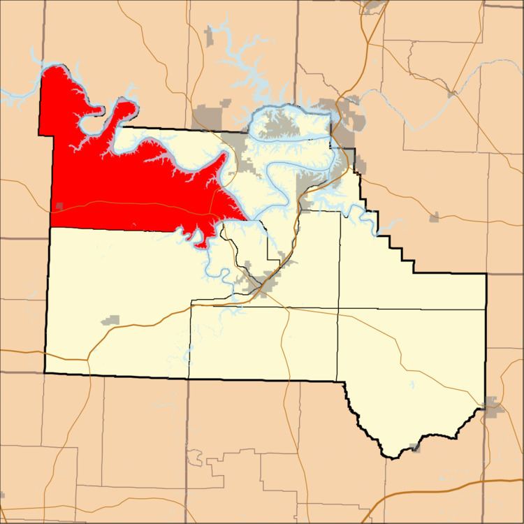
Map of Adair Township, MO, USA
Adair Township was erected in 1841.
Geography
Adair Township covers an area of 106.93 square miles (276.9 km2) and contains one incorporated settlement, Climax Springs. It contains nine cemeteries: Adkins, Barnumton, Cable Ridge, Clark, Dority, Granger, Parish, Whitaker and Woolery.
The streams of Bollinger Creek, Dry Branch, Fiery Fork, Jack Branch, Kolb Branch, Lick Creek, Morriss Creek, Pearson Branch, Rainy Creek, Rise Branch, Ritter Branch, Spring Valley Creek and West Pearson Branch run through this township. There are also multiple smaller springs in this township
Public Areas
It contains the Moles Cave State Wildlife Area and Fiery Fork State Wildlife Area which has a canoe access to the Little Niangua River
It also contains one fire lookout tower, the Climax Springs Lookout Tower
Transportation
Adair Township contains one airport or landing strip, Eagles Landing Airport. It also contains Missouri Route 7, and Missouri Supplemental Routes CC, DD, J, NN, and Z.