
Airport type Public 17/35 6,203 Elevation 310 m | Owner City of Ada Elevation AMSL 1,016 ft / 310 m 6,203 1,891 | |
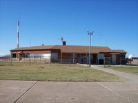 | ||
Ada Municipal Airport (IATA: ADT, ICAO: KADH, FAA LID: ADH) is two miles (3 km) north of Ada, in Pontotoc County, Oklahoma.
Most U.S. airports use the same three-letter location identifier for the FAA and IATA, but Ada Municipal Airport is ADH to the FAA and ADT to the IATA (which assigned ADH to Aldan Airport in Aldan, Russia).
Facilities
The airport covers 770 acres (3.1 km2) and has two asphalt runways: 17/35 is 6,203 x 100 ft and 13/31 is 3,103 x 50 ft.
In the year ending September 12, 2005 the airport had 12,250 aircraft operations, average 33 per day: 98% general aviation and 2% military. 48 aircraft are based at the airport: 83% single engine, 10% multi-engine and 6% jet aircraft.
References
Ada Municipal Airport Wikipedia(Text) CC BY-SA