
Source elevation 1,054 m | Length 53 km | |
 | ||
Main source Black Forest1,054 m (3,458 ft) Similar | ||
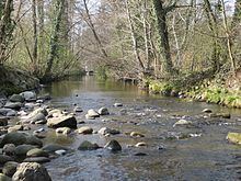
The Acher is a river in the district of Ortenau, Baden-Württemberg, Germany and a right tributary of the Rhine River. It flows in an eastwesterly direction from the Black Forest toward the Rhine, between the Rench River to the South and the Oos River to the North.
Map of Acher, Rheinm%C3%BCnster, Germany
Its source is located near the top of Schliffkopf Mountain (Black Forest) at an elevation of 1,054 metres (3,458 ft) above sea level, above Ottenhöfen. From there it runs through the Acher Valley until it enters the Upper Rhine River Plains near Achern and flows into the Rhine near Lichtenau.
References
Acher Wikipedia(Text) CC BY-SA