
Area 20.26 km² | ||
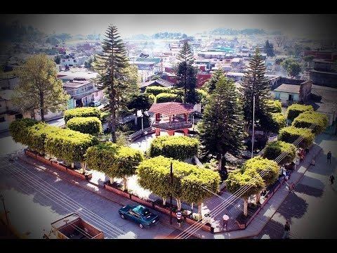 | ||
Acatlán is a municipality located in the montane central zone in the State of Veracruz, about 35 km from state capital Xalapa. It has a surface of 20.56 km2. It is located at 19°42′N 96°50′W. The villagers tell that there was once an individual that come from a place called Cerrillos, of origin authentic totonac, was attracted by the excellent pastures that existed where today Acatlán is. Moved by such an attraction he proposed to take possession of the rich pastizales. To help to his emotions he kidnapped a maiden of his village and with her he went to establish to form a home among the reed-grasses and the exuberant pastures. This way there grew a family that with the time would be Acatlán's community.
Contents
Map of Acatl%C3%A1n, Ver., Mexico
Geographic Limits
The municipality of Acatlán is delimited to the east by the Tepetlán, to the south by the Naolinco, to the west by the Miahuatlán, and to the north by Chiconquiaco. It is watered by the rivers Actopan and Pájaro Verde.
Agriculture
It produces principally maize.
Celebrations
In Acatlán , in September takes place the celebration in honor to Señora de los Remedios, Patron of the town, and in December takes place the celebration in honor to Virgen de Guadalupe.
Weather
The weather in Acatlán is cold and wet all year with rains in summer and autumn.