
Population 200 (2011 Census) Post town BIGGAR Local time Tuesday 2:14 PM | OS grid reference NS931234 Sovereign state United Kingdom Postcode district ML12 Dialling code 01864 | |
 | ||
Weather 4°C, Wind SE at 8 km/h, 82% Humidity Lieutenancy areas South Lanarkshire, Lanarkshire | ||
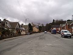
Abington is a village in the Scottish council region of South Lanarkshire, close to the M74 motorway, marking the point where it changes name to the A74(M), following the upgrade of the former A74 road. The West Coast Main Line between Glasgow and London also emerges from the Clyde Valley at this point and begins its ascent up Beattock Summit, alongside the motorway. Abington was at one time served by a station on the railway, but this was closed as a result of the Beeching cuts of the 1960s.
Map of Abington, Biggar, UK
There is a post office in the village, as well the Upper Clyde Parish Church building.
The village gives its name to the Abington services, which lies about one mile north.
References
Abington, South Lanarkshire Wikipedia(Text) CC BY-SA