
Established 1856 Area 15.4 km² Local time Tuesday 2:22 PM | Municipality Dr Beyers Naudé Postal code (street) 6270 Population 7,162 (2011) Area code 049 | |
 | ||
Weather 37°C, Wind W at 31 km/h, 14% Humidity | ||
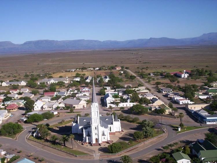
Aberdeen is a small town in the Sarah Baartman District Municipality of the Eastern Cape province of South Africa. With its numerous examples of Victorian architecture, it is one of the architectural conservation areas of the Karoo.
Contents
Map of Aberdeen, South Africa
Town some 55 km south-west of Graaff-Reinet, 155 km east-south-east of Beaufort West, 32 km south of the Camdeboo Mountains. Laid out on the farm Brakkefontein as a settlement of the Dutch Reformed Church in 1856, it became a municipality in 1858. It is named after Aberdeen in Scotland, birthplace of the Reverend Andrew Murray of Graaff-Reinet, relieving minister.
The Aberdeen Provincial Hospital is situated in Aberdeen.
References
Aberdeen, Eastern Cape Wikipedia(Text) CC BY-SA