
Type Road Opened 1930 | Length 20.1 km (12 mi) Route number(s) A38 | |
 | ||
History Superseded State Route 29 in 2013 Former
route number State Route 29 (1974-2013) Lgas City of Ryde, Ku-ring-gai Council | ||
The A38 is a major arterial route in Sydney, Australia. It runs from the M2 Hills Motorway in North Ryde to the Pittwater Road (A8) in Dee Why. It was formerly designated State Route 29 until mid 2013 when A38 replaced it as part of the statewide alpha numeric shield conversion.
Contents
Map of A38, New South Wales, Australia
The name "A38" is just the route allocation. In fact it is made up of series of roads which, from west to east, are:
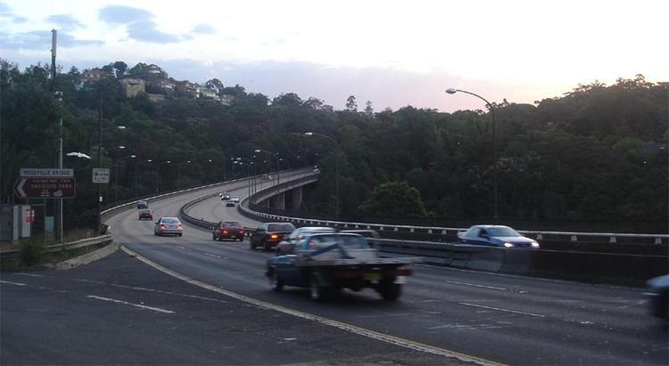
The A38 also has a few notable bridges. They are Fullers Bridge and Roseville Bridge. The Fullers Bridge was built in 1918 while the Roseville Bridge was a newer bridge which replaced an older one in 1966.
History
State Route 29 was introduced in 1974 along with other state routes. Its alignment was the same as the current alignment of A38. In 1997, when the M2 Hills Motorway opened, the then Metroad 2 along Epping Road was decommissioned. State Route 29 was then extended along Epping Road to terminate at Lane Cove Road (then Metroad 3, now A3).
In 2013, A38 replaced State Route 29. According to RMS maps, A38 was truncated to the original State Route 29 alignment, which means A38 now terminates at M2 instead.