
Magnitude 3.8 Mw Areas affected Illinois
United States | Depth 6.2 mi (10.0 km) Max. intensity IV (Light) | |
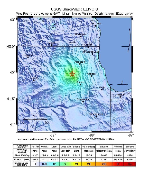 | ||
Date February 10, 2010 (2010-02-10) Origin time 03:59:35 AM America/Chicago | ||
A magnitude 3.8 earthquake hit Northern Illinois at 3:59:35 a.m. CST (9:59:35 a.m. UTC) on February 10, 2010. The earthquake's epicenter was about 43 miles (69 km) west-northwest of Chicago, 2 miles (3 km) east-northeast of the village of Virgil in Kane County, and 2.5 miles (4 km) northwest of the village of Lily Lake, also in Kane County, at a depth of 6.2 miles (10.0 km). The epicenter of the quake was near the Sandwich Fault Zone, which is less active and less known than another fault line in Illinois, the New Madrid Fault. The quake was felt throughout the Midwest, and as far away as Tennessee and Georgia. According to a local geologist, earthquakes in the area are uncommon, occurring only about once every ten years, and not much is known about the fault that they originate from due to the scarcity of quakes to study.