
Magnitude 6.9 Mw Epicenter Gulf of California Tsunami none | Depth 10 km (6.2 mi) Areas affected Mexico | |
 | ||
Date 3 August 2009 (2009-08-03) | ||
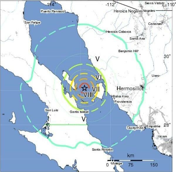
A 6.9 magnitude earthquake occurred in the Gulf of California, between the Mexican states of Sonora and Baja California, on August 3, 2009, at 10:59:56 a.m. PDT (17:59:56 UTC). The quake's epicenter was located offshore, in the Gulf of California, between two islands, only 22 km (14 mi) from Isla Ángel de la Guarda and 36 km (22 mi) from Tiburón Island. It was 89 km (55 mi) north-northeast of Santa Isabel, Baja California, 185 km (115 mi) west of Hermosillo, Sonora. The earthquake occurred along the Tiburón fault zone that is part of the tectonic boundary between the North American plate and the Pacific plate.
The quake rocked buildings in Puerto Libertad, El Desemboque, Punta Chueca, Bahía de Kino, Puerto Peñasco and Hermosillo. It was felt in Ensenada, Tecate, Mexicali and Tijuana. In the United States, the earthquake was felt in parts of Southern California and Arizona.